


Hurricane Beryl made landfall along the Texas coast, just west of Galveston, early Monday morning and while minimal Acadiana is expecting a few impacts.
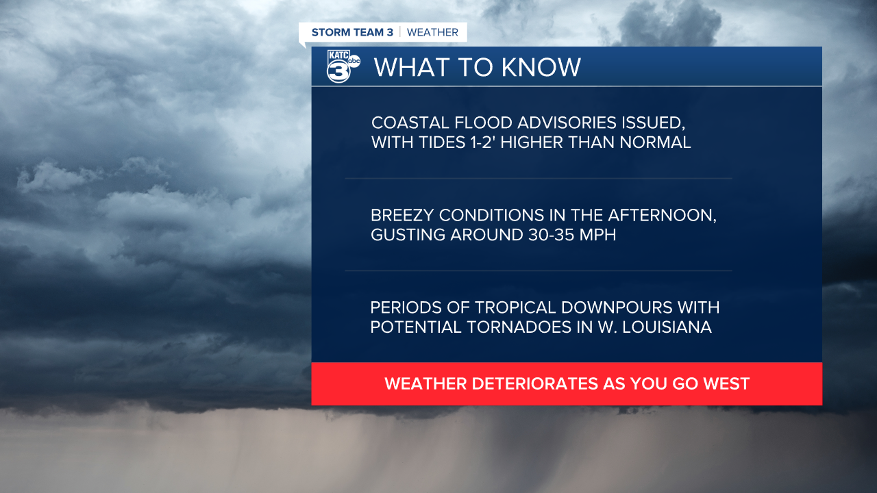
We'll start down along the coast where tides will be running 1-2' higher than normal so expect a Coastal Flood Advisory for Acadiana's coastline in all area's with the exclusion of Cameron Parish.
In Cameron Parish that has been upgraded to a Coastal Flood Warning as water may come up an additional 3' likely producing flooding along Highway 82 as well as some of the beach access roads around Holly Beach.
Coastal flooding is expected to persist through Tuesday afternoon when the southerly winds should start to die down.

The windfield for Hurricane Beryl is fairly narrow, so tropical storm forced winds should stay confined to Texas, but weather will quickly deteriorate as you go west.
We'll still feel Beryl in Acadiana with gusty, tropical winds picking up through the afternoon and peaking in the early evening.
Winds will be out of the south and sustained around 15-20 mph with gusts that could reach as high as 30-35 mph (add this with all the moisture we have hanging around and it will feel very tropical).
This is still strong enough to blow around a few loose limbs but we shouldn't see anything significant and the high tides will likely be the biggest impact from the winds.

Rain totals with tropical systems can be tricky to nail down because you can get such efficient rain that the it can pile up quickly and we will need to watch for some isolated flash flooding.
As the storm moves northwest we'll see our rain chances increase and periods of heavy tropical downpours will be possible through the evening and overnight Monday.
Most areas will receive an inch or two but there are some isolated chances of picking up closer to 2-4" of rain in a pretty short amount of time.
As the rain picks up be mindful that roadways may struggle to drain and to clear and if this is to occur you should avoid any standing water on roadways.
The storms should have enough western trajectory that it will prevent significant training of showers but it's something we'll watch closely for overnight.
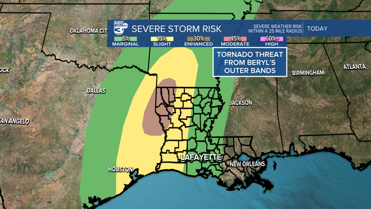
As is often the case the tornadoes will be possible in Beryl's outerbands and a few isolated tornadoes could be possible through Acadiana.
These are often spin up in nature and very hard to spot so if you notice the weather deteriorating be mindful that these will be possible.
The highest chances will be to our north and west so it won't be a major threat for Acadiana but something to keep in mind.
All in all Acadiana is getting pretty lucky with this one, this has been a record breaking, monster storm and could be a flashing warning sign for what's to come this season.
Keep an eye out for my tropical update which will be out later today which will give a look at the tropics beyond Beryl and for the rest of the week.
