


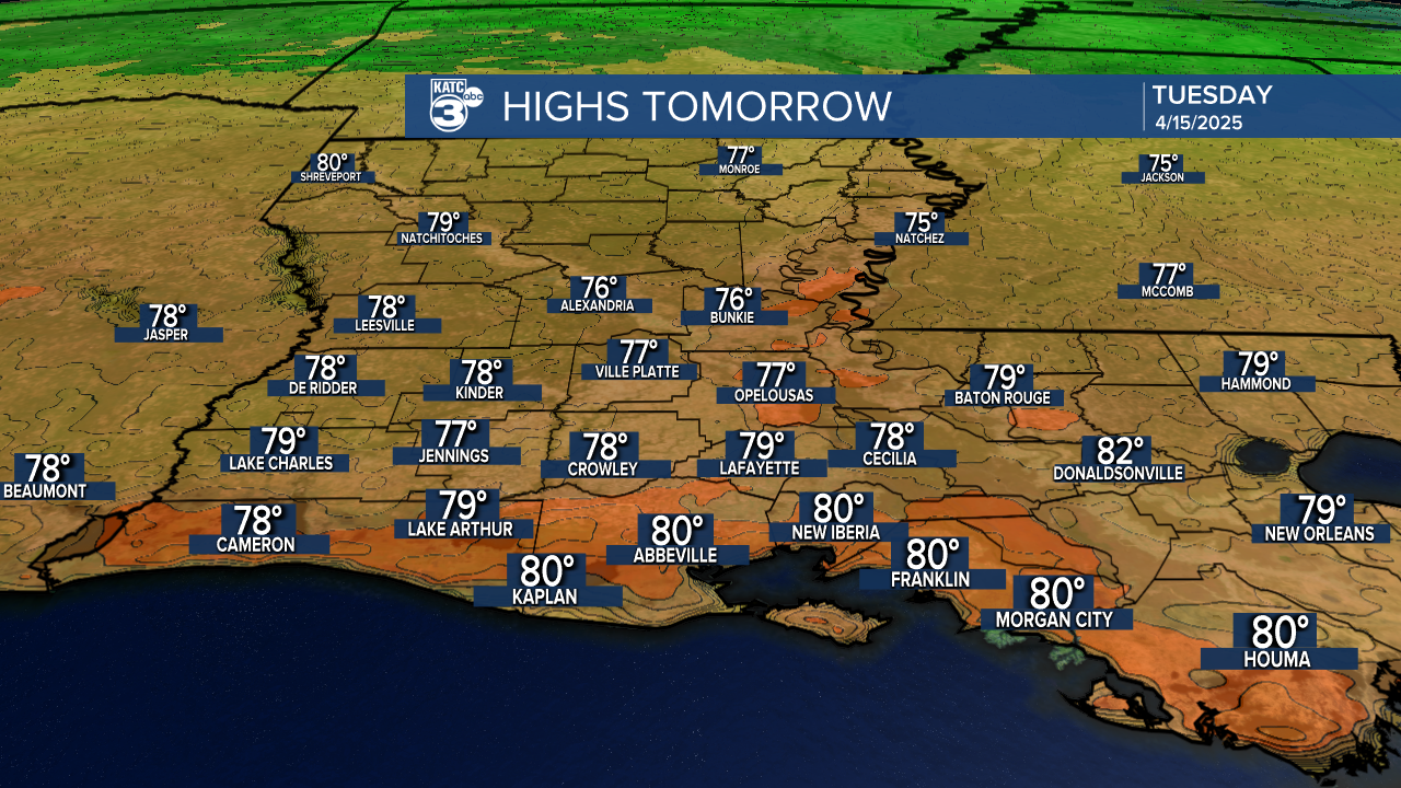
A weak front will push through Acadiana Tuesday with little fanfare other than some clouds and a brief return of a fresh north breeze.

Look for temperatures to start out in the lower 60s Tuesday with readings getting into the mid-upper 70s once some midday clouds clear out in the afternoon.
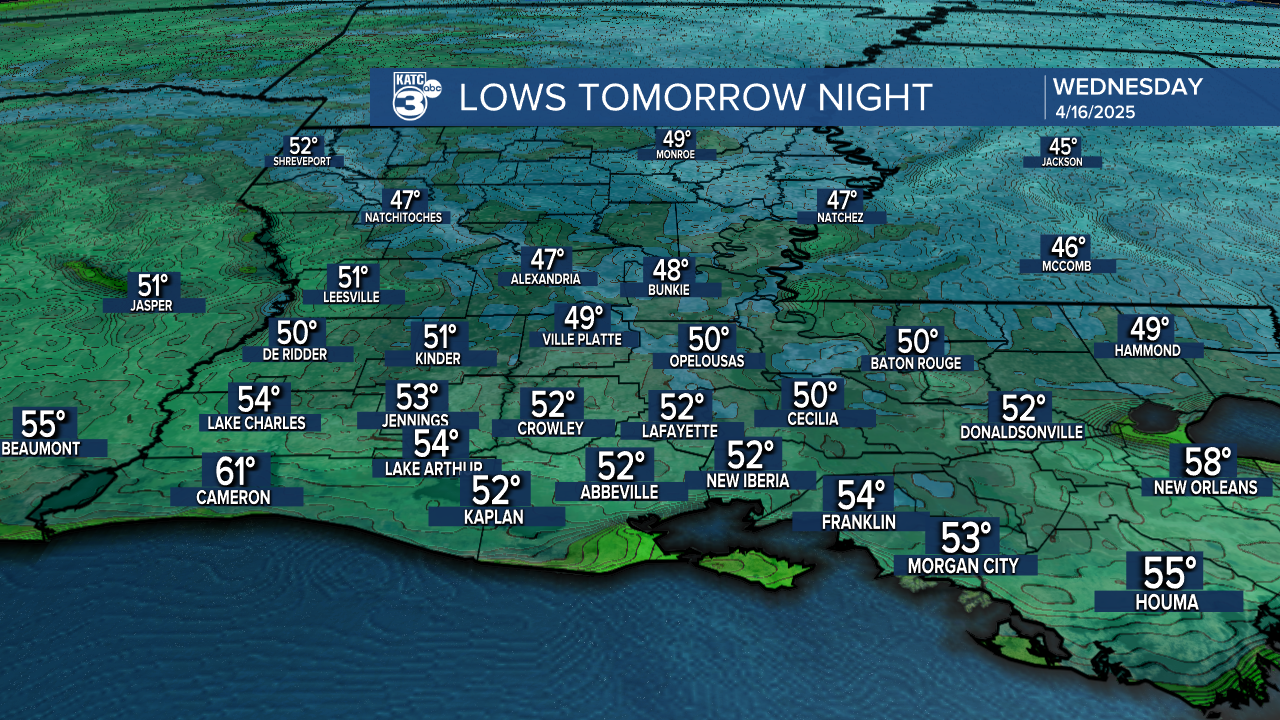
Temperatures will get some 10° cooler into tomorrow night/Wednesday morning, but a return of southeasterly winds means more milder nights to follow.
The forecast for the rest of the week through Saturday looks fair to partly cloudy, seasonably warm and dry.
A few weak upper disturbances will traverse the area starting Sunday into early next week, which could result in a few isolated showers.

Thereafter, for the rest of next week and into the following weekend, the pattern looks more unsettled, with some daily rain chances that may impact portions of Festival International...we'll see.
For now, consult the KATC 10 Day Forecast for the latest.
