

Afternoon Update concerning Beryl which has weakened slightly since it's peak intensity last night:
And latest discussion regarding Beryl's future path:
—————————————————
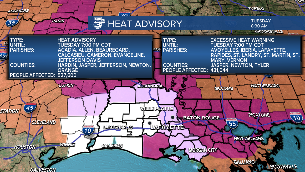
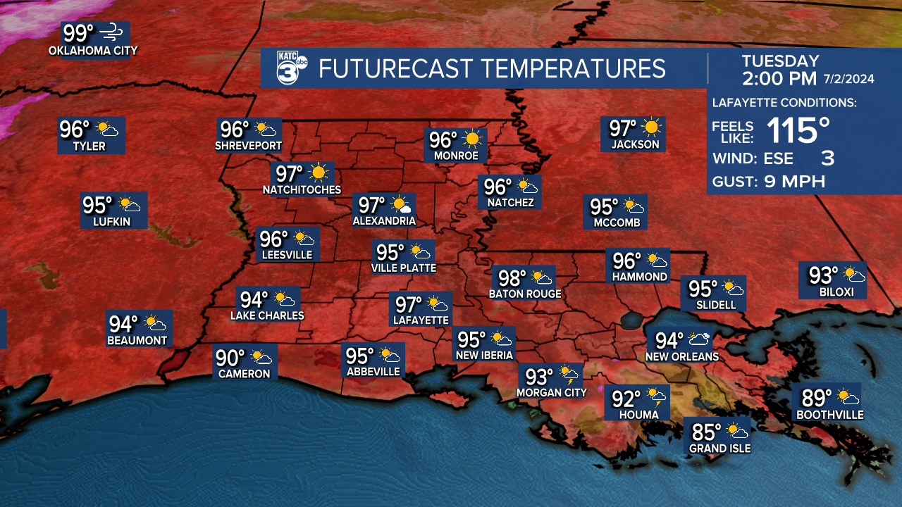
Acadiana is once again facing heat alerts today, with heat advisories and excessive heat warnings in effect. Heat index values are expected to be between 105°-115° this afternoon. It's a perfect time to cool off in the pool or enjoy some ice cream later today. However, remember to take extra precautions if you plan to spend time outdoors.
High temperatures will reach the mid to upper 90s today with mostly sunny to partly cloudy skies. Some areas may experience showers and storms this afternoon due to daytime heating.
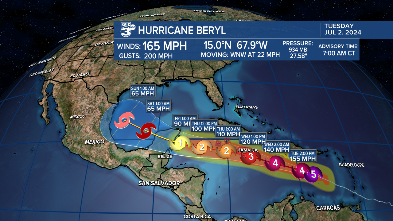
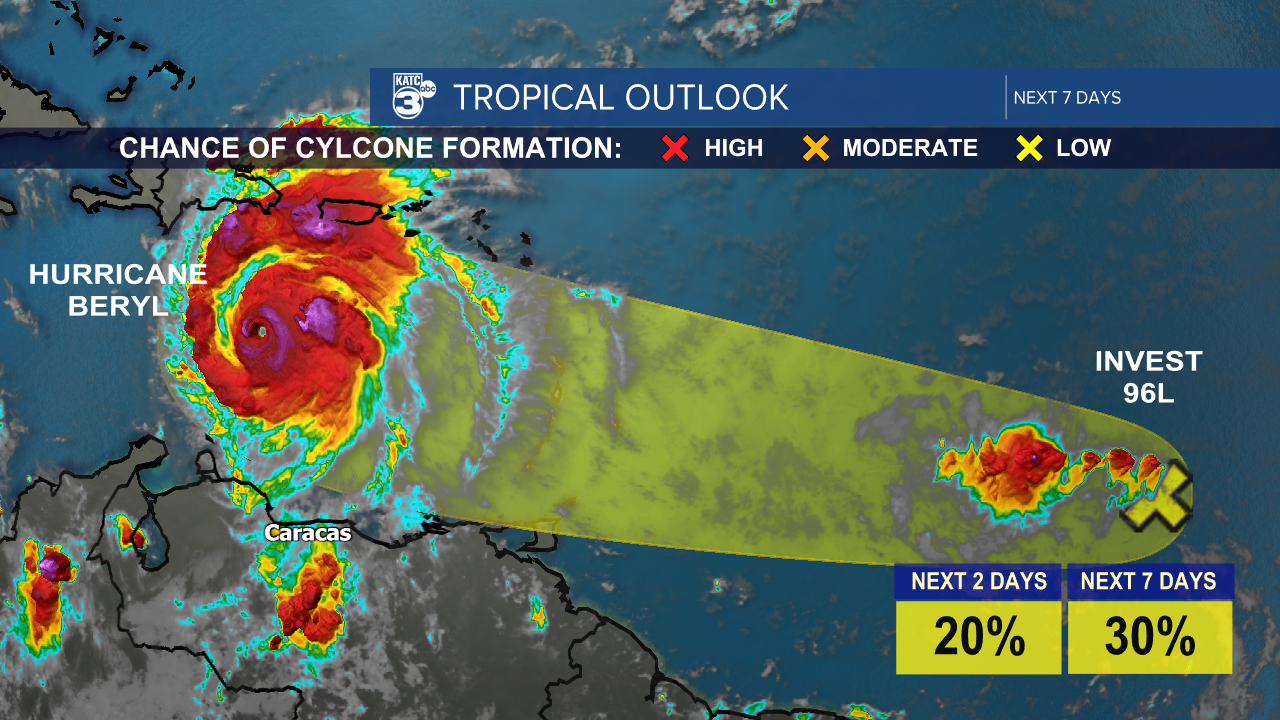
The tropics are currently very active, with Hurricane Beryl at the forefront. Beryl is an extremely powerful category five hurricane with sustained winds of 165 mph, moving towards the west-northwest at 22 mph. It made landfall on the Windward Islands yesterday, causing extensive damage. The forecast suggests that Beryl will continue to be a major hurricane as it moves west, impacting Jamaica and southern Hispaniola by tomorrow. There are multiple tropical storm warnings and hurricane watches and warnings in effect for the areas in its path.

However, models indicate that Beryl will encounter moderate to strong vertical wind shear, along with Jamaica's dry air and elevated terrain, all of which may contribute to the hurricane weakening later in the week.
Looking ahead to the weekend, Beryl is expected to move into the southwest Gulf as a tropical storm after taking a slight northwest turn past the Yucatan Peninsula. Texas and possibly Louisiana could be affected. It's still too early to predict the exact path, but more updates will be available soon. Stay informed and be prepared!
Beryl has set several records:
- It is the earliest category five hurricane on record, beating the record set by Hurricane Emily in 2005 (July 16) by two weeks.
- It is the first major hurricane of the Atlantic Hurricane season.
- It was the earliest category four hurricane on record.
Finally, Invest 96L remains a tropical wave. Although it initially showed potential for developing into a tropical depression, the current conditions are deteriorating.
Follow Meteorologist Breyanna Lewis for further updates.
