


In over a decade of forecasting in Acadiana I'm not sure I've seen so many people excited to be back to a normal late July pattern.
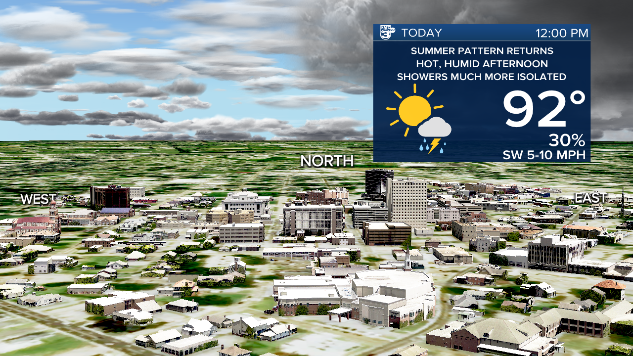
After a very wet stretch of days the last few weeks it will be a "business as usual" type of forecast.
So let's all try to go at least 24 hours before we start complaining about the heat again.
Highs will be back in the low 90s with a heat index around 106, just avoiding the Heat Advisory criteria.
A few pop up showers will be possible but they'll be much more isolated than the last few weeks and really be confined to the afternoon.
Little is expected to change over the next several days so as we close out July we'll do so with some pretty typical weather.
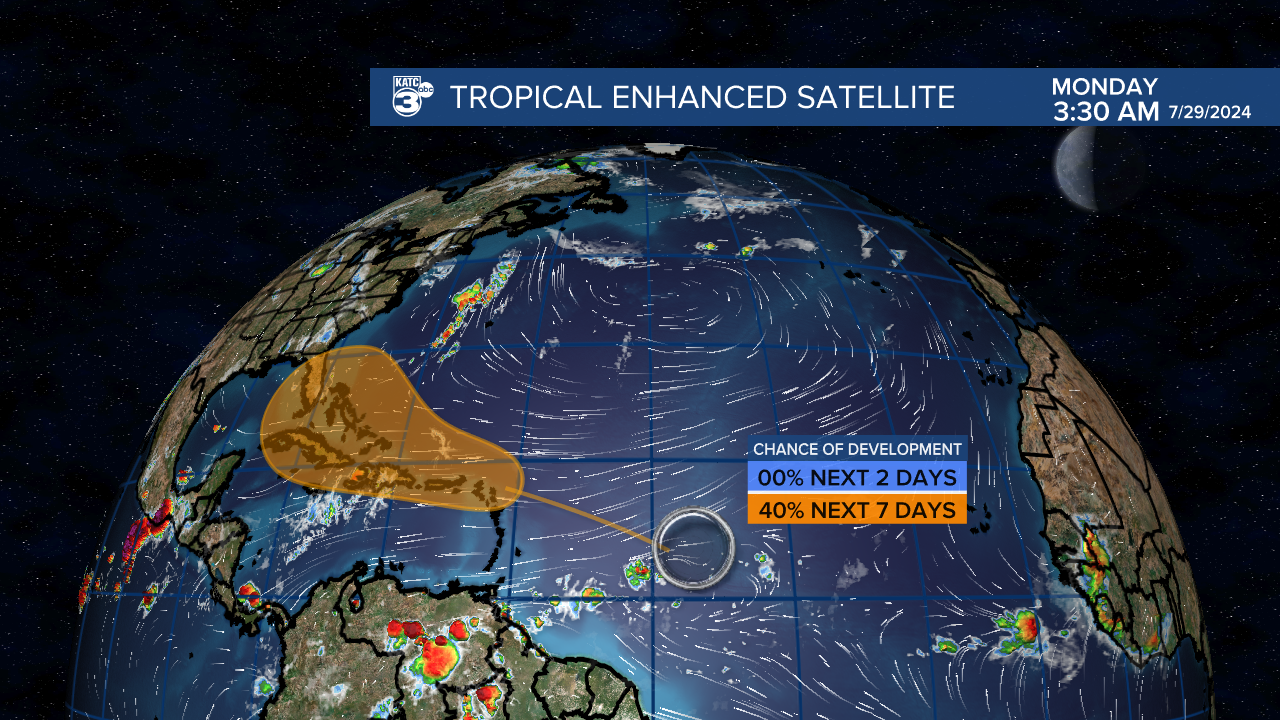
This, of course, also means we're entering a traditionally more active period of the tropics and models seem to be acting accordingly.
There's a wave that's been given about a 40% chance of development as it nears the Leeward Island as it gets into a more favorable area.
If you want a more detailed discussion on the state of the tropics you can find that here.
