
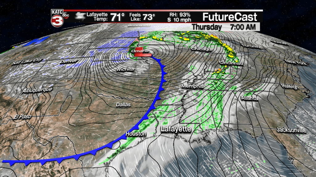
Scattered showers are in the forecast for Acadiana Thursday ahead of a cool front that will bring our temperatures some 10-15 degrees below normal Friday into the weekend.
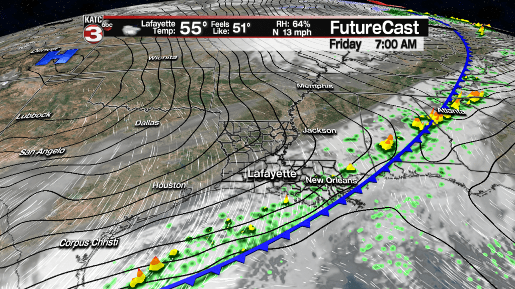
The front should pass through Acadiana around midnight Thursday night, but an active subtropical jet stream with a few embedded disturbances should keep some threat of scattered showers, possibly a few thunderstorms in the forecast for Friday.
Best rain chances Friday will likely be along the coastal parishes.
In the near term, look for breezy conditions overnight (but not as windy as the day Wednesday) through Wednesday morning with temperatures holding near the balmy 70 degree mark.
A few passing showers, at 20%, will be possible as ongoing strong activity in eastern Texas and Northwest Louisiana moves generally to the northeast and loses local dynamics trying to push into our area.
While the Storm Prediction Center (SPC) has western areas of Acadiana hatched in for a “Marginal Risk” of severe storms through daybreak, it does not appear there will be enough atmospheric energy and instability to support such.
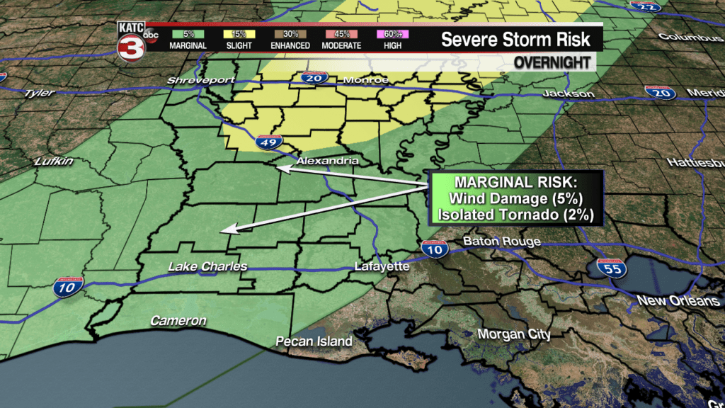
Nonetheless, well keep an eye on the radar:
 Power Doppler HD Acadiana View


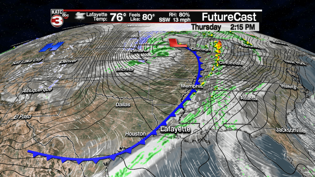
A cool front will advance toward Acadiana Thursday, generating showers, and perhaps an isolated thunderstorm, primarily during the midday into the afternoon/early evening hours.

Latest Predictive Radar:
 Predictive Radar (HRRR Model) 1 Hour Forecast


Like many systems so far this early spring season, rainfall totals will be quite light…likely 1/4″ or less area-wide.

Following the cool front, we expect sharply cooler temperatures Friday into the weekend, but we may not be done with the rain Friday as an active subtropical jet stream will allow for more scattered showers, perhaps even some thunderstorms, especially for the coastal parishes.
Rain chances for Thursday are slated to be in the 60-70% range, while Friday should be closer to 40%…but those numbers may change (especially for Friday) so consult the latest 24 Hour and 10 Day Forecasts.
Additional rainfall, Friday may add another 1/2″ or a little more primarily for St Mary Parish.
Temperature-wise expect another warm day Thursday with highs reaching the mid-upper 70s, to possibly lower 80s, if we see a few short intervals of sun.

Sharply cool temperatures arrive Friday with high temperatures hard-pressed to reach the 60 degree mark!

It will stay mostly cloudy and cool into the weekend with temperatures remaining some 8-15 degrees below the normals of low 70s during the day and lower 50s at night.
Hopefully we may see a few intervals of sun by Sunday afternoon.
Overall it looks to stay seasonably cool and mostly dry through most of next week, with the prospects of sunshine improving for the mid-week period before a more definitive warm-up (and perhaps the threat of showers and more clouds arrive) into the following weekend.
