
Another day of sunny skies is on tap for Acadiana Wednesday, making it two days in a row of sunshine in spite of well below normal temperatures.
Look for another light freeze for Wednesday morning with temperatures dropping into the upper 20s to lower 30s for a few hours. Just the pets and plants need attention…no pipe worries.
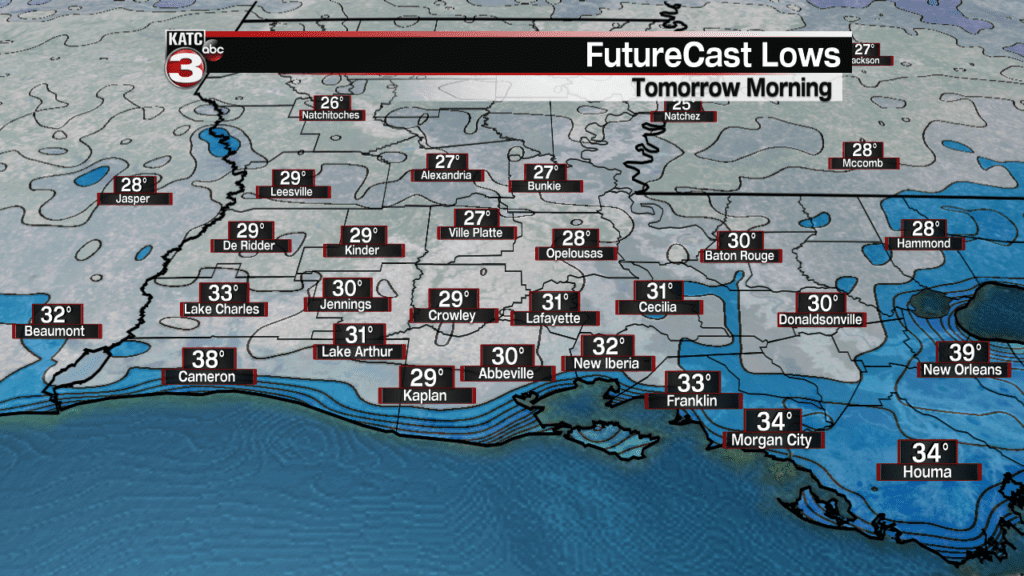
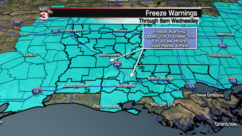
Freeze warnings are in effect for all of Acadiana once again through 8:00 am Wednesday.
Mostly sunny skies Wednesday may yield to some afternoon high level cirrus clouds with temperatures topping out in the mid-50s…which is still roughly 15 degrees below normal for the time of the year.

A trend toward milder temperatures will begin Wednesday night into Thursday morning as high pressure slides to the east allowing for winds to turn east- southeasterly overnight, and then increase from the southeast Thursday.
FutureCast Wind Forecasts:
 Acadiana 1 Hour Wind Forecast


Temperatures Wednesday night should bottom out closer to 40 degrees in most locations.
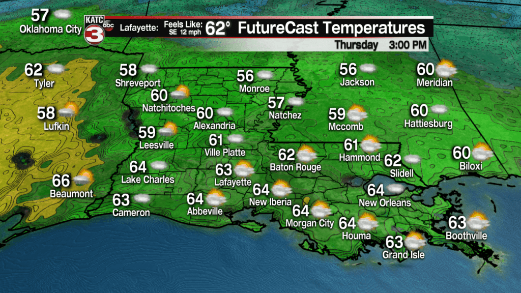
Milder conditions are anticipated for Thursday while as clouds return with the more southerly Gulf winds.
Highs Thursday should reach the low to mid 60s.
The warming trend will continue, along with plenty of clouds Friday with highs pushing back into the lower 70s by the afternoon.
Rain chances Friday will be in the 10-20% range of a few showers that may accompany the warmer and increasingly moist Gulf flow.
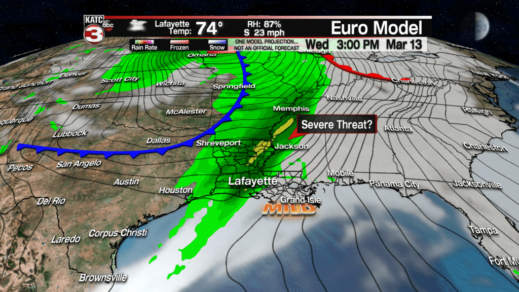
Moving into Saturday, another strong storm system will develop in the Plains with a trailing cold front that will likely produce scattered to numerous showers and thunderstorms into Louisiana and perhaps, Acadiana

In addition, there will likely be some sort of severe weather threat for Acadiana northward into Arkansas and Mississippi and surrounding areas.
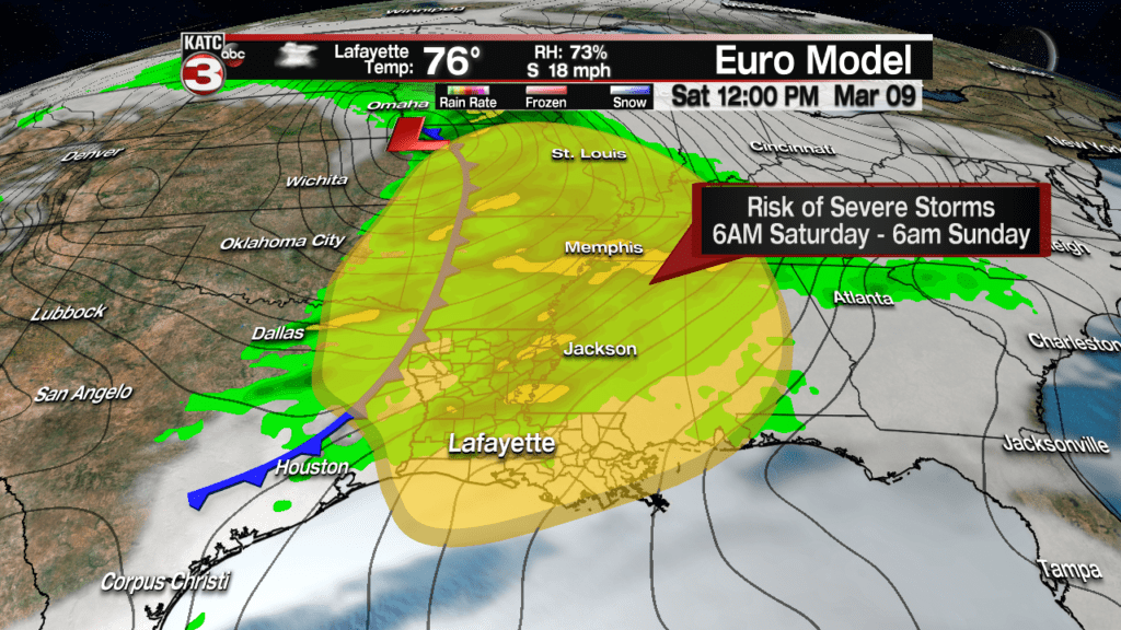
The Storm Prediction Center has much of the area hatched in for a “slight risk” (level 2 out of 5) of severe storms Saturday, with the risk possibly going higher to our north, and perhaps portions of Acadiana could slip downward to a marginal risk (level 1 out of 5)…stay tuned.
After Saturday, the forecast looks rather unsettled with the aforementioned cool front becoming a quasi-stationary boundary across the area Sunday through Tuesday keeping clouds, and some rain chances possible in the area during this period. See the latest 10 Day Forecast.
Another dynamic storm system and frontal boundary may yet again produce a good chance of storms locally, and perhaps present another severe weather threat by next Wednesday.
It is beginning to look like the spring severe weather season will continue in the weeks ahead.
