As the cold front pushes off to the east skies will gradually clear across Acadiana tonight and cooler air will slide down over the region as lows Sunday morning will dip into the mid to upper 40s.
Here is a look at the latest hour-by-hour temperatures.
There could be a few lingering high clouds to start our Sunday but finally we should have a bright, sunny day with seasonable temperatures in the mid 60s.

Now there will be a little bit of a breezy out of the north so standing in the shade with the wind blowing will make it feel on the cool side so you might want at least a light jacket if you are heading out to the Scott parade.
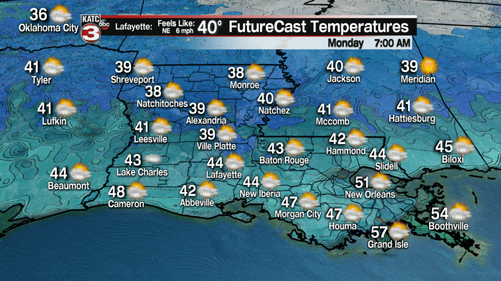
The coldest temperatures will be Monday morning when lows fall into the upper 30s to lower 40s.

After some sunshine Monday morning clouds will build back over the region during the afternoon holding highs in the low to mid 60s.
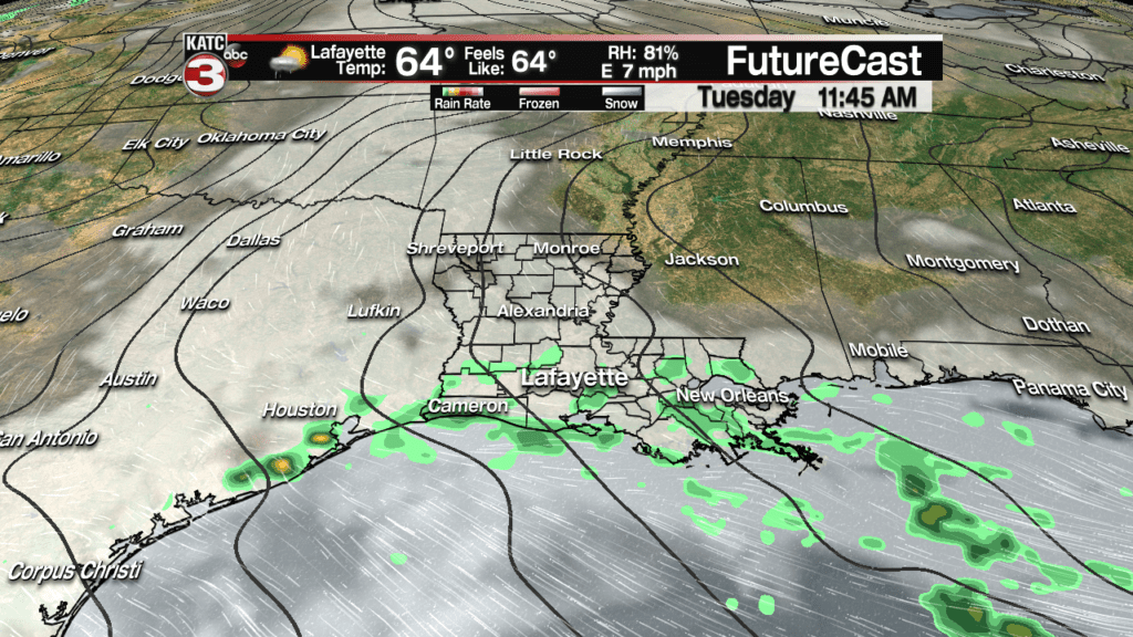
Late Monday into Tuesday the sub-tropical jet swings back over the region causing scattered showers to return to Acadiana, especially for those along the coast, but rain chances will only be about 40%.

We might get a break in the rain Wednesday but we will still have lots of clouds with temperatures on the rise as winds flip out of the south as highs warm into the mid 70s.
Rain chances go back up to about 40-60% on Thursday as an impulse looks to roll through Acadiana.

Looking at the extended forecast for Friday through Mardi Gras we stay in this yucky El Nino pattern with lots of clouds, although there will be peeks of sunshine, especially on Saturday and Sunday, with slight rain chances each day but no day looks to be a wash out and hopefully like today the showers will miss the parades.
Stay tune to KATC for the latest on the Mardi Gras forecast.
Here is a look at the extended European Model:


