
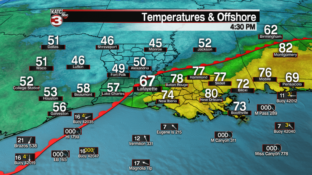
A warm front moving through Acadiana Thursday night will allow for milder temperatures, misty drizzles, and a good chance of scattered showers out ahead of the front through the overnight hours.
A Dense Fog Advisory is in effect for most of Acadiana from 8 pm Thursday evening through 10 am Friday behind the warm front, with the ubiquitous mist, drizzle, and a few spotty showers likely overnight.

Latest Fog Products:
 Current Visibility


Temperatures will gradually rise to near 70 Friday morning, and then likely approach 80 degrees Friday afternoon.
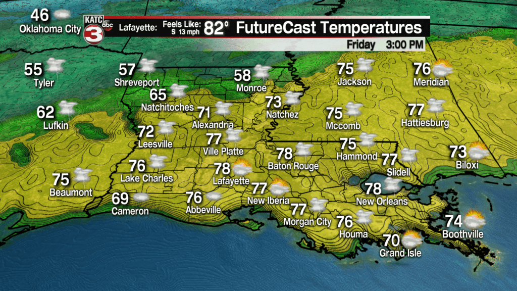
While most showers and storms should stay north of the area Friday, there will be the risk of scattered afternoon showers, possibly a thunderstorm, with rain chance Friday near 40% or less.
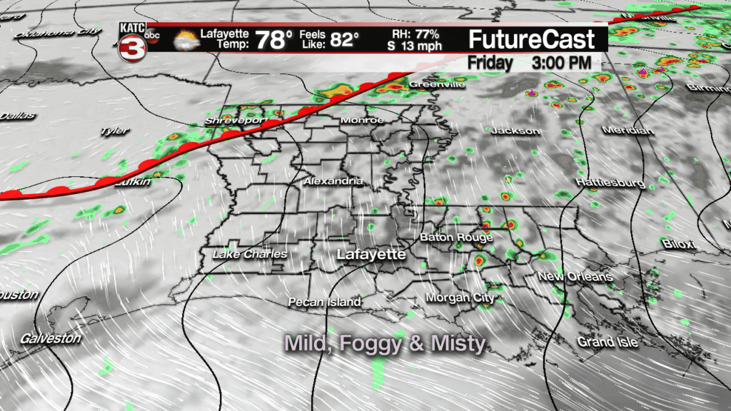
Expect more fog and mist with patchy drizzle into Friday night, but it shouldn’t be a washout for the Krewe de Canailles Parade Friday evening.
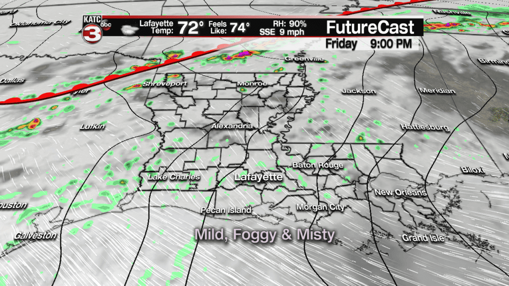
Temperatures will stay comfortably mild Friday evening with temperatures holding near the lower 70s.
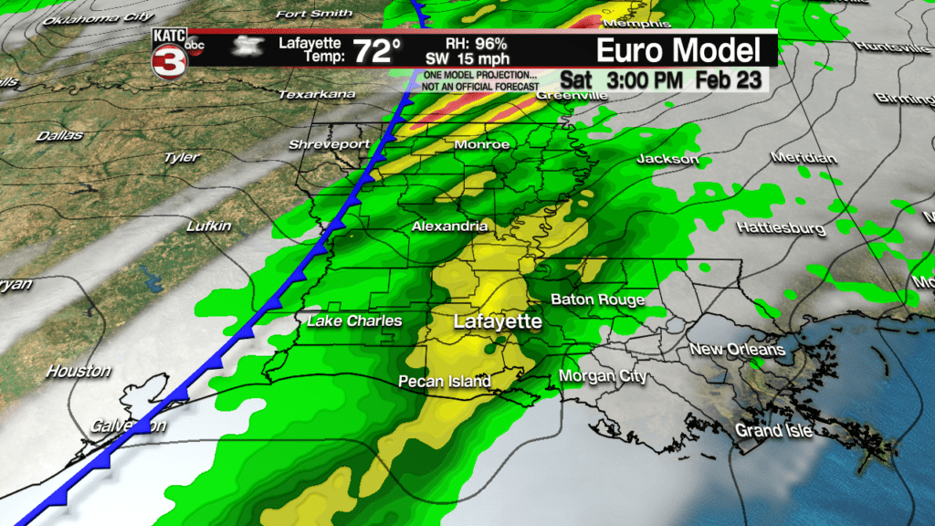
A cold front associated with a potent storm system to the north will usher a cold front through the area Saturday bringing an excellent chance of showers and thunderstorms.
Currently we are thinking the highest rain chances may come early to mid Saturday afternoon.
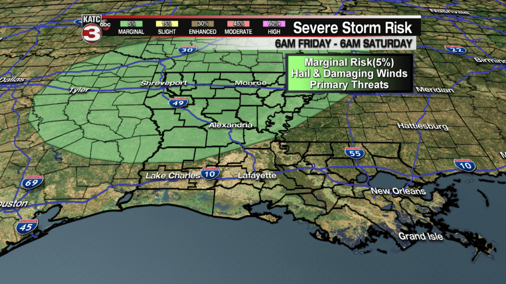
The Storm Prediction Center (SPC) has portions of Louisiana hatched in for a marginal risk of a few severe storms Friday, mainly associated with activity along and north of the warm front with hail and perhaps damaging winds as the primary threats.
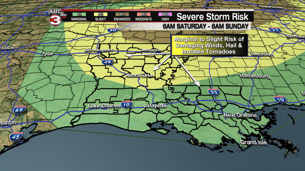
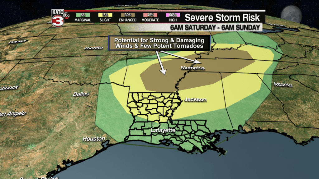
The risk of severe storms will increase across all of Louisiana with the cold front, with the greatest threat developing into the northern/northeastern part of the state.
The front may generate a few severe storms across Acadiana Saturday with the primary threat being wind damage, but an isolated tornado cannot be ruled out. The dynamics will be much stronger with this system to the north.
In fact, the severe storm risk will be considerably higher into Arkansas and into the Tennessee River Valley…areas that have been pummeled by heavy rains in recent days and will get more big rains and an “enhanced risk” of storms, that could be capable of intense damaging winds greater than 70 mph, and perhaps a few strong tornadoes (EF2 or stronger).
While storm timing for Acadiana Saturday is still not set in stone, today’s models are offering the highest rain chances from midday through the afternoon…this might impact the Carencroand Krewe des Chiens Parades, but the storms may end in time for the big Rio Parade Saturday evening.
If we get really lucky, perhaps the storms come in between all the local Mardi Gras parades, and that’s what we will hope for.
The bottom line, keep the rain gear handy through Saturday. I’ll be driving a KATC vehicle in the Rio Parade, so you’ll be able to get a direct update from me along the route!
Drier air will move in for Sunday with a mixture of clouds early and then some sun possible for the afternoon.
Temperatures will be cooler Sunday, but they should be rather seasonable with highs in the mid-60s and lows Sunday night in the mid-40s.
The weather pattern into next week doesn’t look too great, but it doesn’t look as dreary as it has been of late…but that’s subject to change.
In addition, the models and that pattern are hinting at pretty chilly weather arriving to the Gulf Coast into the first week of March…no predictions yet however, for Mardi Gras…stay tuned and keep up with our latest 10 Day Forecast for now!
