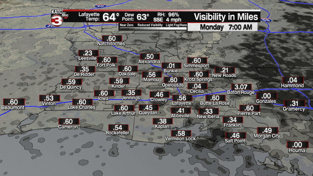
No real changes to the weather pattern in Acadiana for the next several days.
That means we will have sea fog develop every night and push inland during the overnight hours.
Thus, make sure you give yourself extra time in the morning, especially if you live south of the interstate where the fog will be the thickest with visibility down to 20-30 feet.

Then during the day the fog/low clouds will gradually mix out leading to a few peeks of sun in the afternoon with temperatures warming into the mid 70s.
With the fog and low level moisture in the atmosphere a stray shower can not be ruled out, especially Monday and Tuesday, but for the most part we will remain dry.
The best chance for showers in Acadiana will be late Thursday night into early Friday morning when the models are forecasting our next cold front to swing through the region.

But even then the models are not showing much in terms of rainfall with many spots only get a tenth to maybe a quarter of an inch of rain.
Behind the front it will get breezy and cold again with temperatures falling into the lower 50s by Friday afternoon and overnight lows could fall into the upper 30s and lower 40s by Saturday morning.
After the chilly start on Saturday next weekend should be okay with highs in the upper 50s on Saturday and near 70 on Sunday with partly sunny skies.

