
Tuesday 10 pm Update…
The models are coming in wetter for tomorrow than previous runs, especially for Southwest Louisiana. Rainfall will range from 1/2-2″ across the region. Comparison of HRRR and RPM Models here:


Original Story:
A moderately strong cold front will push through Acadiana early Wednesday morning, with showers accompanying the front, and more likely, colder rains to follow for most of the day.
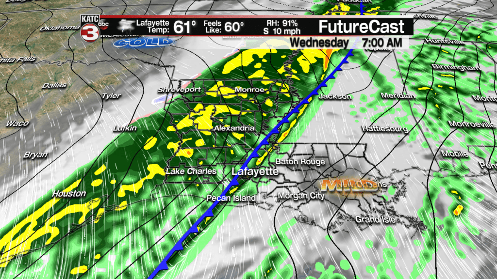

Latest Predictive Radar:
 Predictive Radar (HRRR Model) 1 Hour Forecast


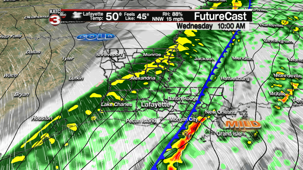
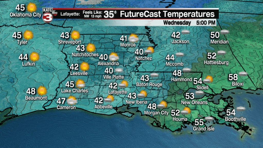
Mild temperatures overnight through Wednesday morning will be in the low to mid 60s, but will drop into the upper 40s by noon and the lower 40s by late in the day.
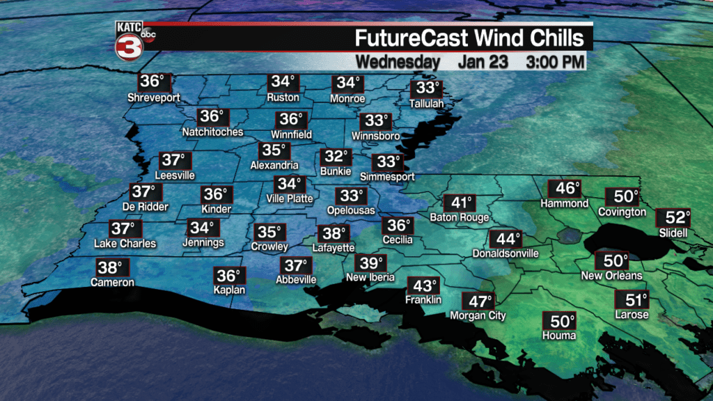
With breezy northwest winds following the front, wind chills will be dropping into the mid-upper 30s by day’s end.
So in addition to bringing an umbrella with you before you head out the door in the morning, grab your winter coats too!
Rain totals will not be an issue, with most of us likely catching near 1/2″ of rain…a few isolated spots may receive up to an inch.

Overall most activity Wednesday will be in the form of rain, but an isolated rumble of thunder cannot be ruled out…there will be no severe weather threat whatsoever.
The rains will taper into Wednesday evening with breezy and cold conditions expected through daybreak Thursday.
Temperatures will once again be flirting with the freezing mark Thursday and perhaps Friday mornings.
Latest FutureCast Temperature Forecasts:
 1 Hour Temperature Forecast


Look for mostly sunny conditions Thursday and Friday with highs in the 50s.
The next weather system looks to miss most of Acadiana to the west and then the south as the next area of low pressure drops into the Gulf of Mexico.
We are maintaining slight rain chances because of this system, but it appears most of us will be dry this weekend.
Look for mostly cloudy skies Saturday and partly sunny skies Sunday with highs both days near 60, while night-time lows drop into the upper 30s.
After a nice and milder Monday with highs in the low to mid 60s it may get a little more “interesting” with the next front that may have deeper arctic air with it.
While showers are forecast Tuesday with highs in the 40s, temperatures will be dropping again and there is a very slim chance there could be a little wintry mix in the precipitation briefly Tuesday, mainly for the northern-most portions of Acadiana…no accumulations are expected.
All long range models have local temperatures in the mid-upper 20s come next Wednesday morning, but like the last few cold shots, the models have been overly aggressive with the cold…it should be noted that the last few runs of the Euro Model puts Acadiana close to the hard freeze territory Wednesday morning…so something to watch.
See the latest 10 Day Forecast for our best estimations.
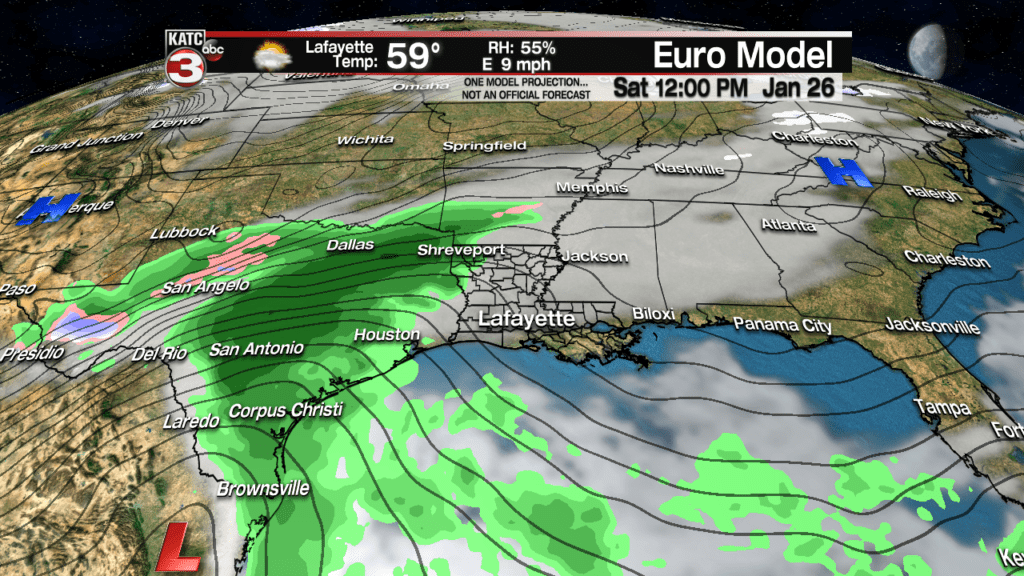
Latest European Model:
 European Model Forecast Day 1


After a sunny and cool Wednesday, another re-enforcing shot of cold air should arrive following rain (and briefly milder temperatures) Thursday into Friday and the following weekend.
