
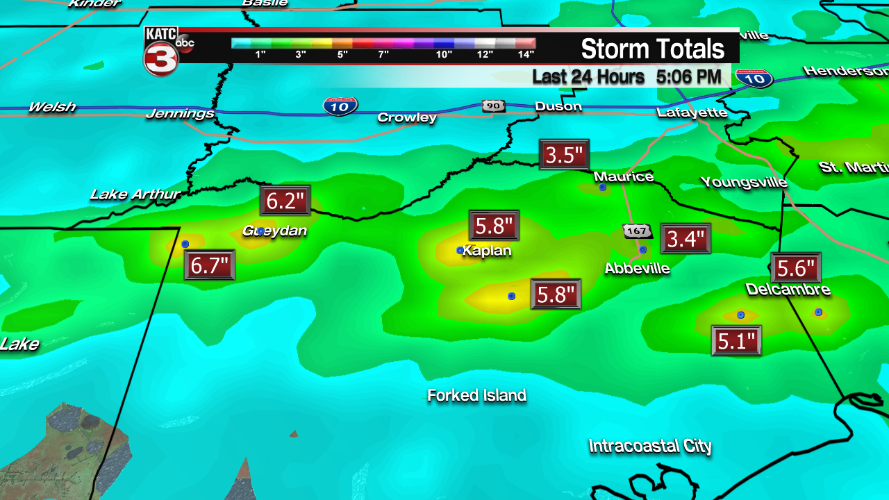
Very heavy rainfall fell across portions of Acadiana Wednesday afternoon leading to a flash flood warning for a good part of Vermilion Parish through 6:30 pm where more than 6 inches of rain fell in spots.

An additional 2-4″ of rain will be possible along and south of a cool front that will drop down to the coast by Thursday morning.

Predictive Radar has consistently forecast the possibility of additional flood threats as cells are expected to reform and “train” from west to east over some of the same areas through this evening.
So additional flood advisories and or warnings may be possible into Wednesday evening.
Latest Predictive Radar:
 Predictive Radar (HRRR Model) 1 Hour Forecast


Stay with KATC, katc.com and social media feeds through this evening.
Moving into Thursday, it should be a much quieter day with regard to the radar, with a few passing, mainly light showers possible, at 20-30%, under mostly cloudy skies.
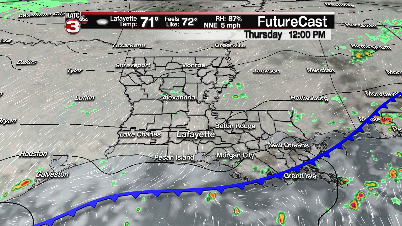
Temperatures will start out in the mid-60s Thursday and top out in the more seasonable low mid-70s.
A big change in the pattern comes Friday as a strong front blasts through the area during the morning hours, with periods of chilly rain showers likely following the front through the afternoon.
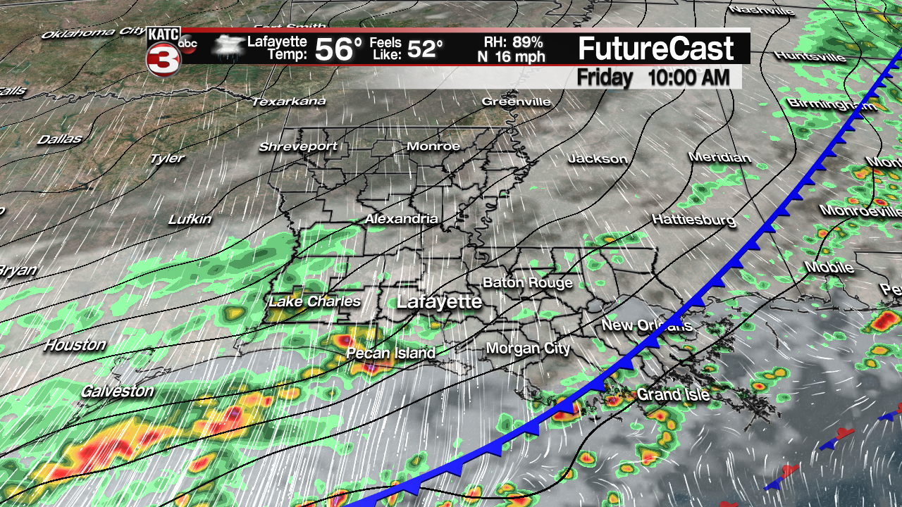
It will be sharply cooler, and feel even colder Friday, with temperatures dropping and holding in the mid-50s accompanied by a stiff north breeze.
We are not looking for a whole lot of rain Friday with rain totals likely to be in the 1/2 inch range or less, but it will certainly feel rather miserable thanks to the chilly temperatures and the aforementioned gusty north winds.
Latest FutureCast:
 Futurecast 3 Hour


The rains will taper into Friday evening with a bit of a break Saturday.
This weekend will be the coolest of the fall so far, with highs expected to stay in the 50s while lows drop into the mid-40s.
High clouds will likely linger Saturday, with perhaps with a little dull sunshine possible, but the clouds will thicken by late in the day in advance of another disturbance riding along and north of the front Sunday.
Look for another day of chilly rains Sunday, with the possibility of up to another inch or two of rain, but due to the progressive nature of Sunday’s system, no flooding is anticipated.
Clouds, and perhaps some lingering showers will persist into Monday.
After that, the long range models continue to show a strong early season Canadian front working its was through the area Monday night into Tuesday.
This could lead to not only the coldest air of the season mid-week, but a few opportunities at frost and/or freezing conditions for Wednesday, Thursday and perhaps even Friday mornings.
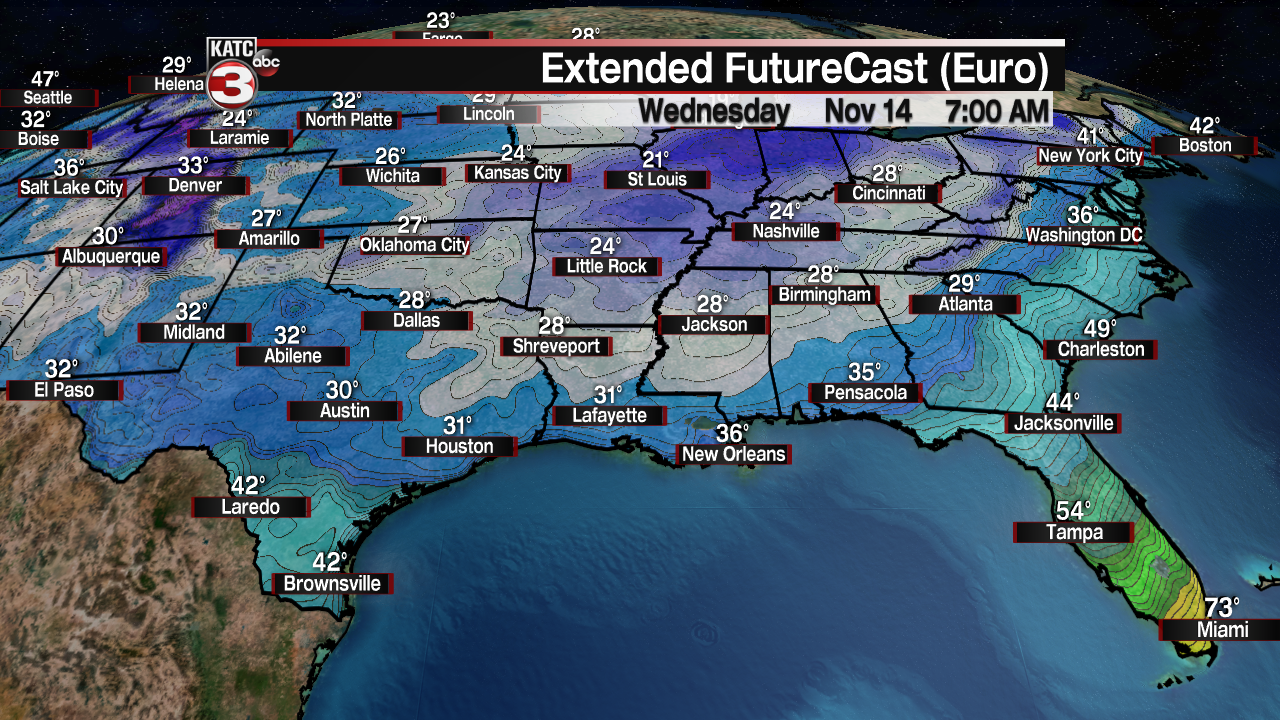
We’ll have a better feel the sharpness next week’s cold as we get closer to the event in the days ahead.
European Model:
 European Model Forecast Day 1


