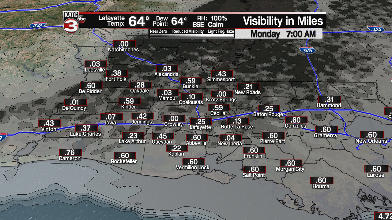
Sunday’s showers produced about an inch of rain for most of Acadiana and with the ground still damp tonight patchy to dense fog is a good bet with visibility dropping below a quarter of a mile by Monday morning.

Once the fog burns off it should turn into a nice day with a mix of sun and clouds and warm temperatures as highs will top out in the low to mid 80s.
The above average temperatures are the result of a warm front pushing north over the region bring with it the chance for a few isolated showers Monday afternoon.
Monday afternoon/evening the warm front will combined with a strong front as it swings through the mid Mississippi Valley producing a good chance for strong to severe storms with several tornadoes likely for portions of Mississippi, Alabama, Tennessee and Kentucky as they are under an enhanced risk for severe weather by the Storm Prediction Center.

Early Tuesday morning the tail end of the cold front from this system will slide through Acadiana producing a few scattered showers and storms.
For a look at the timing of these showers and storms here is a look at the latest Futurecast.
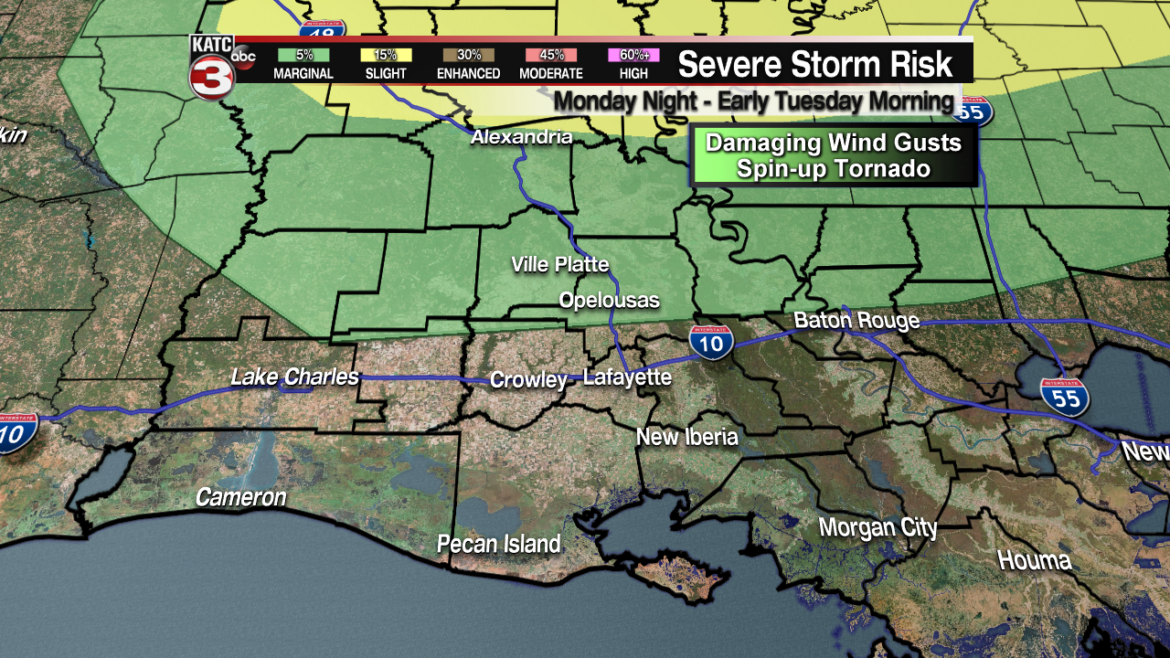
The good news is with the latest update from the Storm Prediction Center most of Acadiana has been removed from the severe weather threat but areas from Highway 190 on northwards you are still under a marginal risk(5%) for a few storms to maybe have damaging winds gusts up to 60 mph or a brief spin-up tornado.

The showers should clear out by mid morning meaning Election Day should be another nice day with partly cloudy skies and highs on the warm side in the mid 80s.
After Tuesday our weather turns unsettled as a stationary front will set-up over top the region and a couple systems will ride along the front producing several rounds of scattered showers and storms Wednesday and Thursday.
Late Thursday night into early Friday morning our next cold front looks to sweep through Acadiana producing another round of scattered showers and storms.
For a look at the rainy pattern for the second half of the work week here is a look at the latest European Model.
Once this front clears the region Friday afternoon winds will pick up out of the northwest and it will get cool again as highs Friday will only top out in the low to mid 60s, with a few northern communities staying in the 50s.
Saturday morning lows will dip down into the low to mid 40s.
This time the cool temperatures will be sticking around all weekend and lasting for much of the following week as highs look to stay in the mid 60s with overnight lows in the mid 40s each night.


