
The threat of severe storms will increase dramatically overnight for Acadiana as a cool front accompanied by robust wind dynamics aloft will move through the region with activity ending closer to daybreak Thursday.
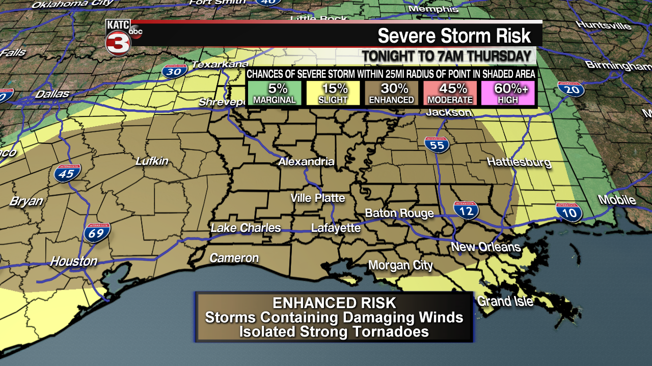
The Storms Prediction Center (SPC) has all of Acadiana hatched in for Enhanced risk (a level 3 out of 5) of severe storms overnight…a rarity for these parts.
The primary risk of severe weather, with a 30% chance of a storm occurring within a 25 mile radius, will be cells that could contain damaging winds in excess of 70 mph.
In addition, a few strong tornadoes will be possible with that risk near a 10% chance within a 25 mile radius or anywhere in the enhanced area for severe storms.


Per Predictive Radar, it appears that the strongest dynamics for severe storms will occur primarily from midnight through 5 am, but subtract a couple of hours for western sections of Acadiana, and add a couple of hours for eastern sections of Acadiana.

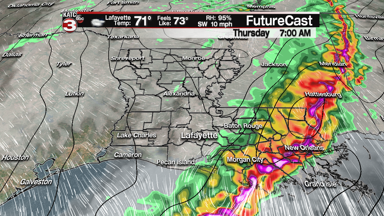
See the latest Predictive Radar and rainfall projections based of of this model here:
 Predictive Radar (HRRR Model) 1 Hour Forecast


The bottom line, stay informed by keeping with with KATC TV, katc.com, and KATC social media accounts…we’ll be manning our weather, news and production facilities overnight.
Showers and storms will end right around daybreak for most areas with mostly cloudy skies and a few passing sprinkles/light showers possible through midday. A peek of the sun will be possible into the afternoon hours.
Temperatures will stay in the 70s overnight, and we’ll be watching the dew points very closely, if dew points stay above 72, and get closer to the mid-70s, severe weather will be much more likely.
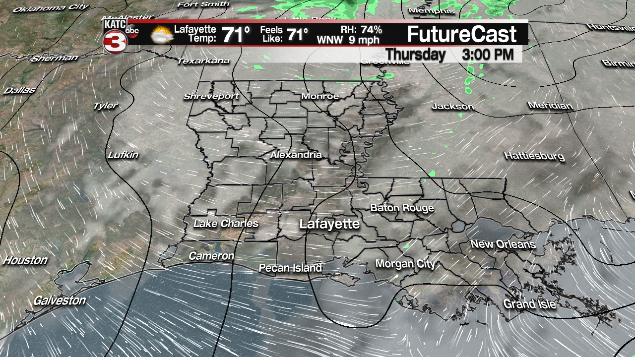
Latest FutureCast Model:
 Futurecast 3 Hour


As for rainfall, a solid soaking of 2-3″ will be likely…some isolated spots might see more, which could lead to localized street flooding closer to daybreak, but widespread flooding is not expected with this system due to the storms being rather progressive.


Temperatures will likely stay in the upper 60s to lower 70s Thursday with readings cooling into the lower 50s by Friday morning.
FutureCast Temperature Forecast:
 1 Hour Temperature Forecast


After some morning clouds early Friday look for sunny and seasonably cool conditions through Saturday into early Sunday.
Clouds, and perhaps a few widely scattered showers may be possible late Sunday, but better prospects of showers and storms will come Monday into Tuesday of next week.
Long Range Forecast:
 European Model Forecast Day 1


Interestingly enough the forecast looks cooler and cooler toward the end of next week and perhaps into the following weekend…so it may feel like November after all for the first week of November!
In the near term, stay weather aware through the next 12 hours.
