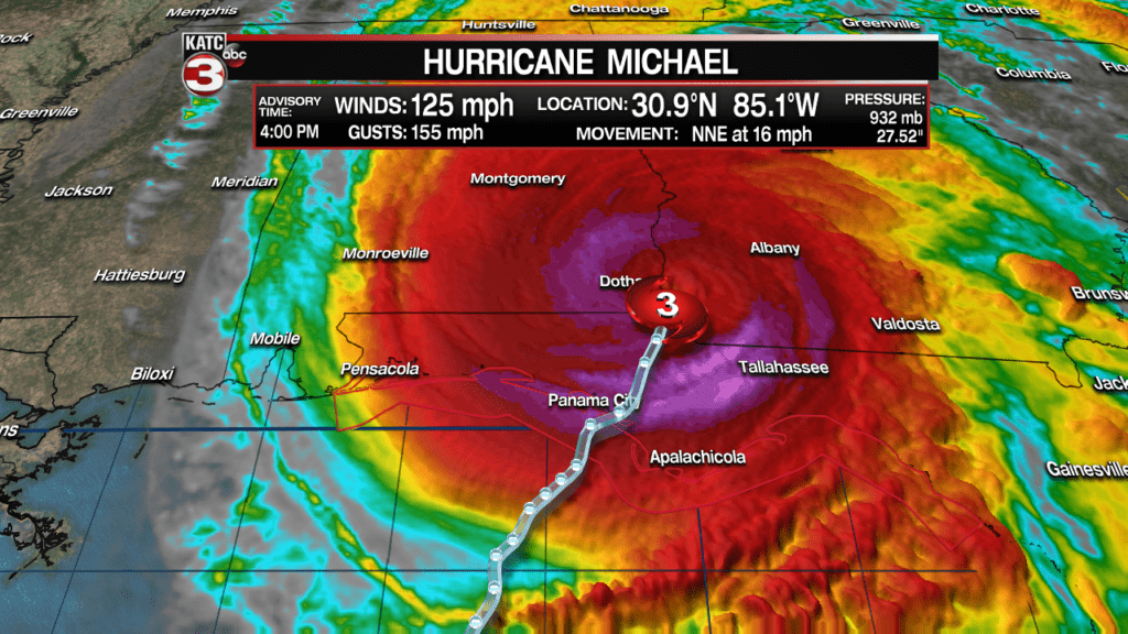
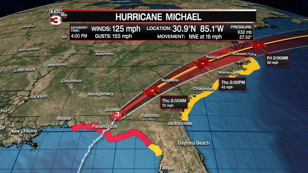
Hurricane Michael begins to weaken more significantly, down to 125 mph winds as of 4 pm. Michael remains a dangerous Category three storm as it heads inland into Southern Georgia this weekend.
The storm will become a tropical storm by Thursday morning, but will likely bring tropical storm conditions through the Carolinas into Friday.
Latest National Hurricane Center Bulletin.
—————————————————————————————-
3:00 pm Update:
Hurricane Michael remains a extremely dangerous Category 4 hurricane with 140 mph sustained “catastrophic winds” continuing well inland, and heading for portions of extreme southeastern Alabama and Southern Georgia.


Current Hurricane and Tropical Storm WarningsHere’s the latest bulletin per the National Hurricane Center:
...3 PM CDT POSITION UPDATE...
...EYE OF MICHAEL APPROACHING I-10 IN THE FLORIDA PANHANDLE...
...LIFE THREATENING STORM SURGE AND CATASTROPHIC WINDS CONTINUE...

Radar data indicate that the eye of Michael is now moving inland
over portions of Jackson County in the Florida Panhandle and is
nearing Interstate 10. Everyone in these areas is reminded not to
venture out into the relative calm of the eye, as hazardous winds
will increase very quickly as the eye passes!

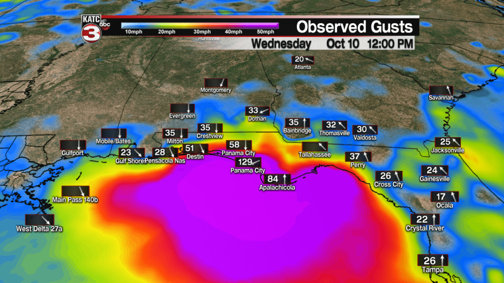
Recently reported wind gusts include:

Marianna Florida airport: 102 mph (164 km/h)
University of Florida/Weatherflow Mexico Beach: 83 mph (134 km/h)
Panama City Beach National Ocean Service: 80 mph (129 km/h)
Tallahassee International Airport: 71 mph (115 km/h)
Donalsonville Georgia: 67 mph (107 km/h)
Downtown Tallahassee: 63 mph (101 km/h)

Dangerous storm surge continues along the coast of the Florida
Panhandle. A National Ocean Service water level station at
Apalachicola is still reporting over 7 feet of inundation above
ground level.


SUMMARY OF 300 PM CDT...2000 UTC...INFORMATION
-----------------------------------------------
LOCATION...30.6N 85.2W
ABOUT 10 MI...20 KM S OF MARIANNA FLORIDA
ABOUT 55 MI...90 KM WNW OF TALLAHASSEE FLORIDA
MAXIMUM SUSTAINED WINDS...140 MPH...220 KM/H
PRESENT MOVEMENT...NNE OR 25 DEGREES AT 15 MPH...24 KM/H
MINIMUM CENTRAL PRESSURE...927 MB...27.37 INCHES
Video from Hurricane Michael can be viewed below:


