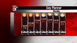
Summer really wants to hang on for this last week of summer. Afternoon temperatures should easily climb into the low to mid 90s with heat index values exceeding 105 degrees! Much of this is thanks to the remnants of Florence, that is now pushing toward the northeast at a faster forward speed. On the back side of Florence, a bit of a ridge of high pressure and a northerly flow will generally keep the afternoon sea breeze thunderstorms away, except for the late afternoon hours, allowing maximum heating during the day.
This pattern is expected to linger into the mid part of the week, with temperatures back in the normal range by the weekend and perhaps a bit of a better chance for afternoon storms. The first full week of fall generally looks hot too, but there are indications on models that a patter change may be coming toward the end of next week into early October. Fingers crossed!
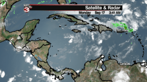
Other than Florence, Tropical Depression Joyce remains in the eastern Atlantic Ocean and won’t be a threat to North America. The remnants of Isaac remain in the Caribbean near Jamaica and will continue drifting westward. It doesn’t look organized at all today, and the National Hurricane Center is only betting 20% that it will reform over the next few days. We’ll continue to keep watch there this week, but no reason to be concerned today.


