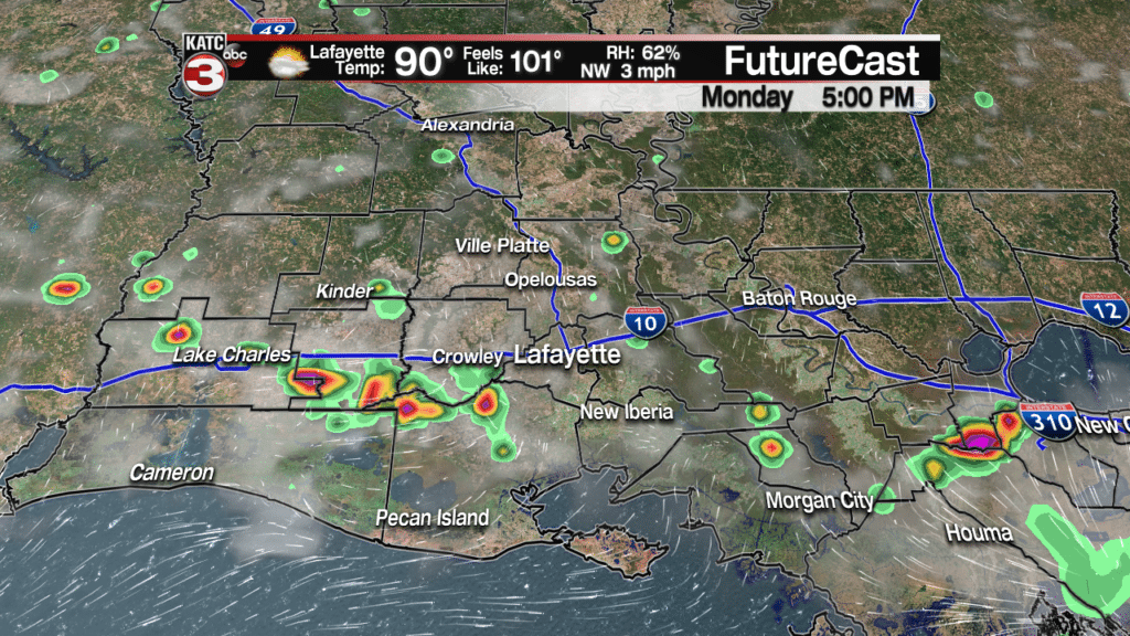
This week is going to feel more June or July than the middle of September as highs will continue to be in the low to mid 90s with heat indices topping out near 105°.

With the summer time heat and humidity we will have the daily 20-30% chance for pop-up showers and storms each afternoon.

These showers and storms could produce some heavy downpours and gusty winds up to 30-40 mph but no severe weather or flooding is expected.
Towards the end of the work week and into the weekend temperatures will come down a little but it is still going to be quite warm with highs in the upper 80s to lower 90s as we will have a bit more clouds and slightly better rain chances(30-40%) as tropical moisture from the remnants of Isaac work into the western Gulf.

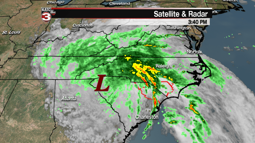
Speaking of the tropics Florence is now down to a tropical depression as the center it moves farther inland towards the western side of South Carolina.

However, steady rains continue to fall for across most of both North and South Carolina but areas along the coast that have been hit the hardest are starting to see breaks in the rain but widespread flash flooding and river flooding is ongoing for the hardest hit areas.
In the Caribbean the National Hurricane Center is still keeping an eye on the remnants of Isaac but the system remains fairly unorganized Sunday afternoon and only has a 20% chance of redeveloping in the next 5 days.

Good news is most models agree this wave will stay a board area of showers and thunderstorms but we could eventually see some of this moisture work into the western Gulf and bump up our rain chances towards the end of the week.
Also, out in the Atlantic Helene is now a post tropical cyclone as it moves through the northern waters and is likely to bring heavy rains and gusty winds to Ireland and the United Kingdom late Monday into Tuesday.

Finally, Joyce has weakened to a tropical depression and is a relatively small storm but could hang on a few more days as it swirls around in the open Atlantic.

