An unsettled pattern is going to start Tuesday and last through the next several days, peaking with a front moving through on Thursday.
An area of low pressure was sitting just offshore early Tuesday morning and will start to eject some showers north through the morning.
Look for rainfall to pick up before lunch time, with on and off showers lasting through the afternoon.

Showers won't be continuous, so there will be breaks in the rain which will allow the water to drain and prevent water from piling up.
The wet weather may take a break Tuesday night, but with clouds lingering the lows will likely sit in the low 60s.
Wednesday will have a few less showers, but it still wouldn't be a bad idea to keep an umbrella with you since a few bursts of wet weather will be hanging around.
Thursday is when the weather is going to peak with the heaviest showers and storms moving through in the morning along an impressive front.

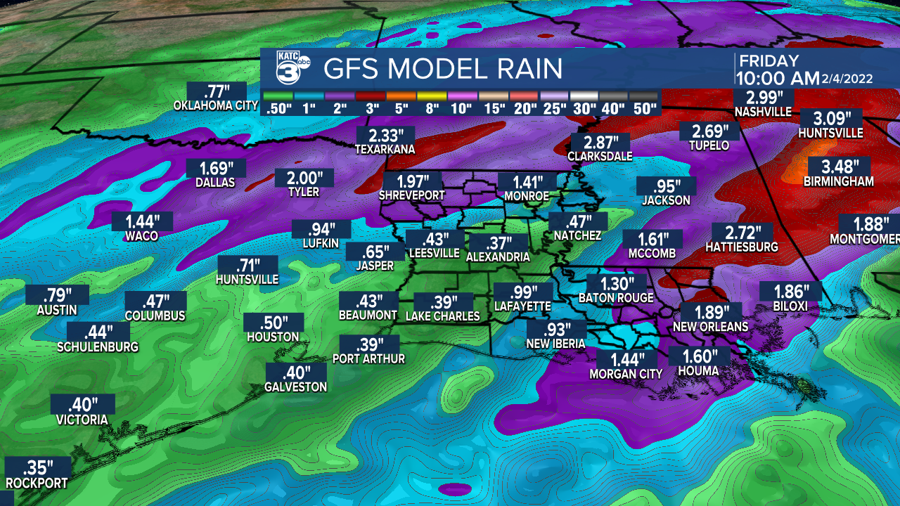
Despite a solidly wet week the rain totals will only be around a half inch to an inch with a few locally higher spots, particularly to our east.
Flooding isn't expected to be a concern and it doesn't look as if we will have a major severe outbreak either, although a few strong thunderstorms will be possible Thursday.
Once that front passes temperatures will drop through the day on Thursday with winter like temperatures back by the weekend.
This front will provide a pretty significant ice storm though central Texas with freezing rain possible along the I-20 corridor, but none of the winter precipitation will make it down to Acadiana.
------------------------------------------------------------
Stay in touch with us anytime, anywhere.
To reach the newsroom or report a typo/correction, click HERE.
Sign up for newsletters emailed to your inbox. Select from these options: Breaking News, Evening News Headlines, Latest COVID-19 Headlines, Morning News Headlines, Special Offers


