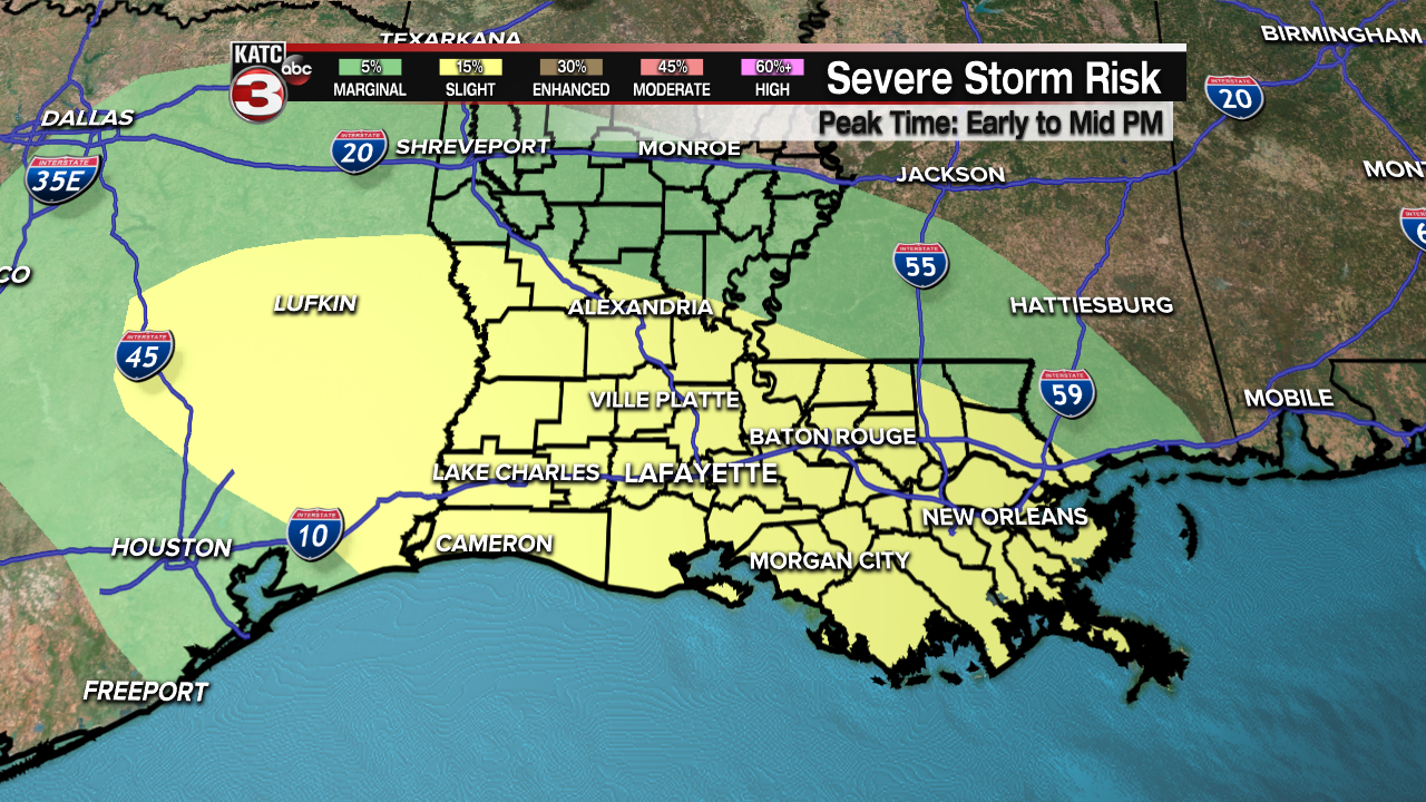
The forecast is settling into a very stormy pattern with likely showers and storms every day this week, with the first of those storms arriving Tuesday afternoon.
A warm front will likely spawn a widespread round of showers with some strong thunderstorms possible, as the SPC has us locked in for a Slight Risk of severe weather.

Storms will be widespread starting around lunch time with the main threats being medium to large hail and strong, gusty winds accompanying some of the storms.
This time of year tornadoes are always possible when the weather gets this way, but they would only be small, spin up tornadoes as the set up isn't quite right for rotation.
The commute both to and from work should be relatively storm free as the worst of the weather will take place through the middle of the day.
Unfortunately this is just round one for the week as the long term pattern will produce rounds of stormy, wet weather that will likely last through the remainder of the week.
Storms on Wednesday will arrive around mid-morning and will once again be sparking another round of possible severe weather.

The rest of the week is shaping up to be pretty stormy with high rain chances through the rest of the work week, this could lead to 3-6 inches of rain across the area.
While there are breaks in the rain after a while we may have a harder time draining out so some minor flash flooding will be possible, especially during some of the heavier downpours.

------------------------------------------------------------
Stay in touch with us anytime, anywhere.
To reach the newsroom or report a typo/correction, click HERE.
Sign up for newsletters emailed to your inbox. Select from these options: Breaking News, Evening News Headlines, Latest COVID-19 Headlines, Morning News Headlines, Special Offers


