


TONIGHT: Mostly cloudy & mild
SATURDAY: Scattered storms & warm
DISCUSSION
SATURDAY OUTLOOK: First round of storms will initiate across Acadiana mid-late morning.

Atmospheric profiles do support hail development during this time period.

Any storms that are able to get going will have the possibility to put down some heavy rainfall as well (not everyone will see rain with this first batch).
I do expect storm coverage to maximize across SE LA Saturday afternoon.
That is when we'll likely see a lull in the action here locally.
However, rain chances ramp up after 10pm as the main cold front works in.

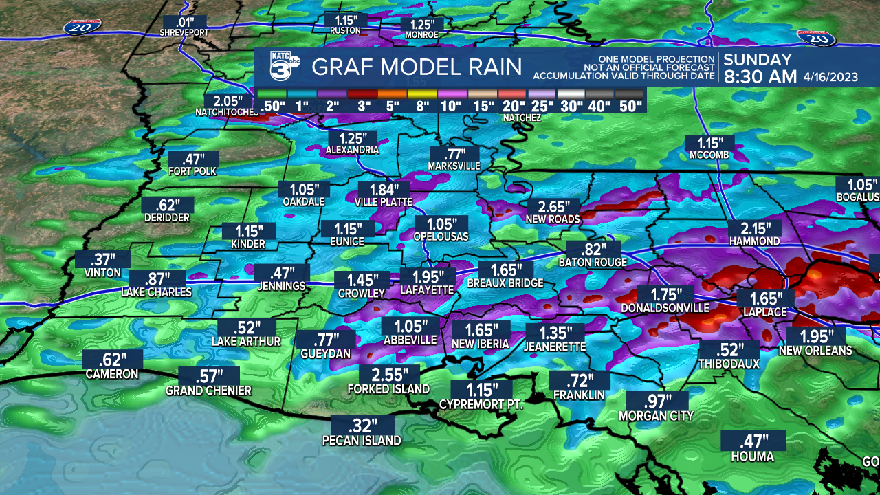
Rain totals are going to be strictly dependent on where some of the heavier thunderstorms set up.
Expect much nicer and cooler weather to follow Sunday into Monday!
We're looking at highs in the 70s with lows in the upper 40s to lower 50s.
Enjoy!
------------------------------------------------------------
Stay in touch with us anytime, anywhere.
To reach the newsroom or report a typo/correction, click HERE.
Sign up for newsletters emailed to your inbox. Select from these options: Breaking News, Evening News Headlines, Latest COVID-19 Headlines, Morning News Headlines, Special Offers
