


We barely kept our 90 degree streak going on Monday as a cloudy day kept thing relatively cool for the first time in seemingly months.
While it is going to be a little warmer Tuesday afternoon it will only be by a few degrees with highs around 93.
A few spotty showers will be possible later in the day along with some thunderstorms, it won't significantly help with drought but something is better than nothing.
Relief will be short lived, however, as hot and dry conditions will return on Wednesday.
Outflow from Hurricane Idalia will create a steady north wind blowing in drier air and increasing our fire conditions for the middle of the week.
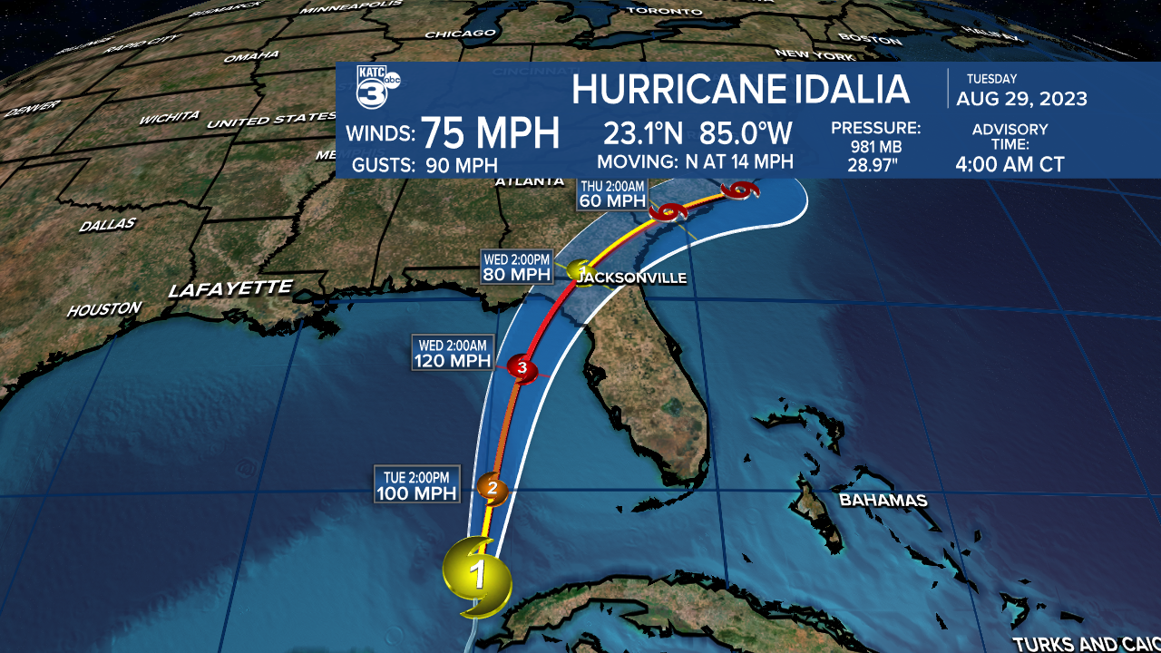
Speaking of Idalia, the storm was officially upgraded to a hurricane on Tuesday morning and it will now begin a period of rapid intensification over the next 24 hours.
Landfall is expected along the Big Bend region of Florida on Wednesday with the storm packing winds close to 120 mph.
Storm surge will be a significant threat from Tampa Bay through to Indian Pass near Apalachicola.
Anyone with interests along the west coast of Florida or the Big Bend region need to monitor the status of this storm.
------------------------------------------------------------
Stay in touch with us anytime, anywhere.
To reach the newsroom or report a typo/correction, click HERE.
Sign up for newsletters emailed to your inbox. Select from these options: Breaking News, Evening News Headlines, Latest COVID-19 Headlines, Morning News Headlines, Special Offers
