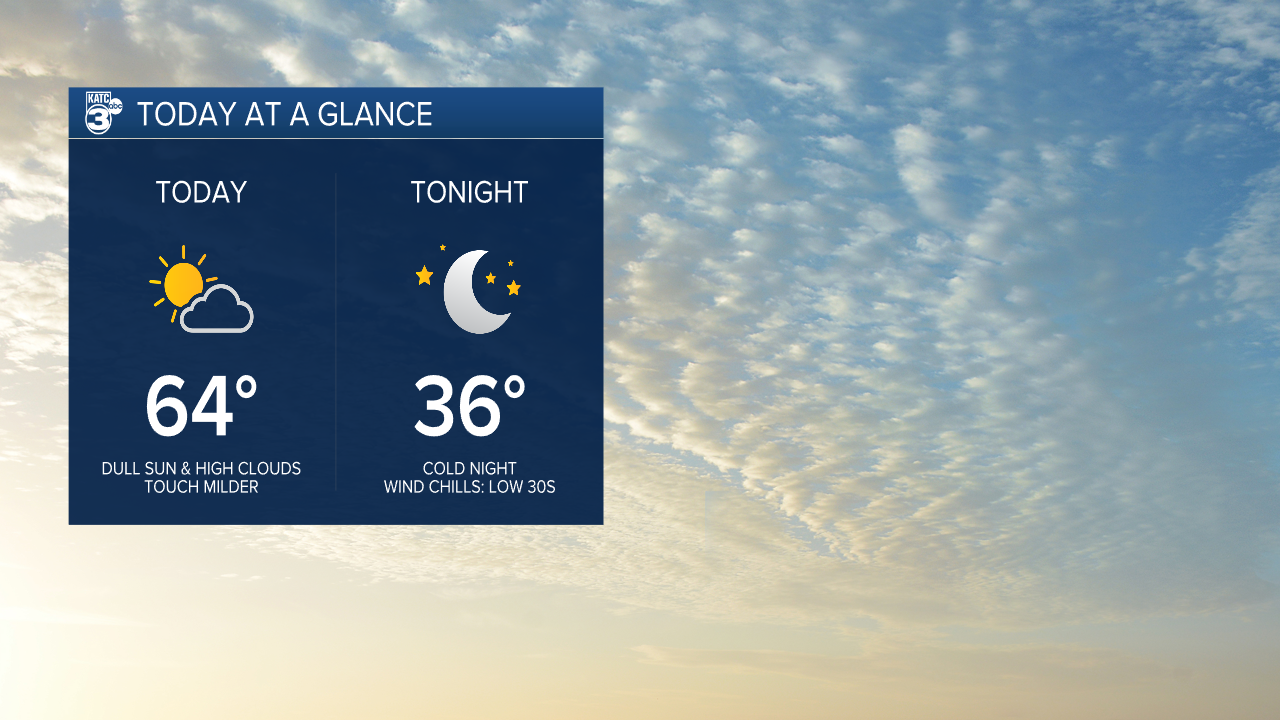

A touch milder for today as highs push the mid-60s.
We're still dealing with an active subtropical jet stream, so expect dull sunshine mixed with high clouds.
Skies clear tonight behind a front and temperatures will tumble.
We'll be in the mid-30s by tomorrow morning with wind chills in the lower 30s!

Mostly sunny and cool afternoons will follow for Thursday & Friday.

Winds will be somewhat breezy out of the northwest.
A light freeze still possible Friday and Saturday mornings.
A brief warm-up will ensure for NYE Sunday (upper 60s).
A few showers will work in during the morning hours New Years Day with a quick moving system.

For now, we should turn drier as the day wears on with temperatures in the 60s.
Have a great day!
------------------------------------------------------------
Stay in touch with us anytime, anywhere.
To reach the newsroom or report a typo/correction, click HERE.
Sign up for newsletters emailed to your inbox. Select from these options: Breaking News, Evening News Headlines, Latest COVID-19 Headlines, Morning News Headlines, Special Offers
