


Acadiana is going to be in a transition on Thursday as we get ready for our next storm system to swing through Friday morning.
Winds will increase through the day and blowing out of the south which will pump the atmosphere full of moisture.
Temperatures will also increase with highs in the low 70s in the afternoon and lows staying in the 60s.

Showers will swing through early Friday morning and aren't expected to linger around for too long.
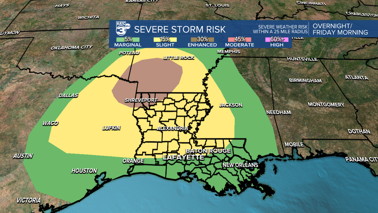
Storms will be possible along the frontal boundary, with the occasional severe storm possible during the morning commute.
The strongest storms still look like they'll be isolated to the northern half of the state but since we're so close we'll keep an eye on the radar regardless.
The front moves through fairly quickly and by mid-morning showers will have come to an end and the skies will slowly be clearing.
Winds will pick up dramatically through the day eventually blowing out of the NW around 20-25 mph with gusts close to 40 mph.
Temperatures will begin falling and lows by Saturday morning will be around freezing so sensitive plants will need to be brought inside.
The rest of the weekend looks quiet with sunny skies and chilly conditions, which will be useful for those who need to get their pipes wrapped ahead of next week.
An arctic outbreak will arrive early next week dropping temperatures into the 20s for the first time this season, which means pipes will need to be wrapped.
Showers look to move through on Monday, ahead of the cold air and likely remaining liquid precipitation.
There is a scenario, however, that a few model runs have picked up on which would delay the precipitation and have it arriving along with the cold weather.
This could lead to a little freezing rain in the area, and would obviously be a much more impactful forecast.
If this were to occur it would be late Monday night into Tuesday morning.
Forecasting these winter systems is one of the hardest things to do in meteorology so it's going to be in flux through the weekend, so make sure you're keeping up to date on the forecast.
Currently (Thursday morning) we will move forward with the assumption that rain will arrive before the cold until a few more models come on board with the other scenario.
------------------------------------------------------------
Stay in touch with us anytime, anywhere.
To reach the newsroom or report a typo/correction, click HERE.
Sign up for newsletters emailed to your inbox. Select from these options: Breaking News, Evening News Headlines, Latest COVID-19 Headlines, Morning News Headlines, Special Offers
