


THIS WEEKEND: Very hot and dry
DISCUSSION
Well, it's back to our regularly scheduled program over the next several days as high pressure aloft dominates the forecast.
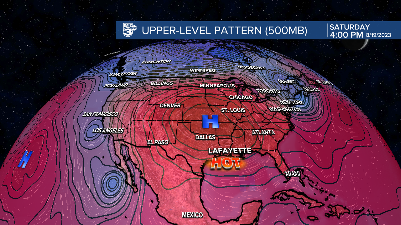
As a result, plan on high heat and low rain chances.
After a start in the upper 70s to lower 80s, expect high temperatures to easily push into the lower 100s both Saturday and Sunday under mostly sunny to partly cloudy skies.
Heat indices will settle into the 110-115 degree range.

A tropical wave will be crossing the Gulf early next week.
Unfortunately, all the moisture associated with it will remain to our south as it heads toward Texas thanks to strong high pressure over the continental U.S.
In its wake, even hotter temperatures as we get into the mid-latter parts of next week—-if you can believe that!
It's the summer that just will not end!
TROPICS
Our tropical wave mentioned above has a 40% chance to develop at least into a depression in the coming days.
Regardless, this system will remain weak and predominantly a rain maker for Texas.
Elsewhere, the Atlantic basin has started to come alive a bit, but no pending threats to Acadiana or the northern Gulf.

If anything, it just serves as a reminder that the peak of the hurricane season is upon us.
Stay will katc for the very latest.
------------------------------------------------------------
Stay in touch with us anytime, anywhere.
To reach the newsroom or report a typo/correction, click HERE.
Sign up for newsletters emailed to your inbox. Select from these options: Breaking News, Evening News Headlines, Latest COVID-19 Headlines, Morning News Headlines, Special Offers
