DISCUSSION
After several inches of rain fell across Acadiana this morning, a lot of the area has seen a lull in the action this afternoon allowing for drains to catch up (exception being St. Mary).
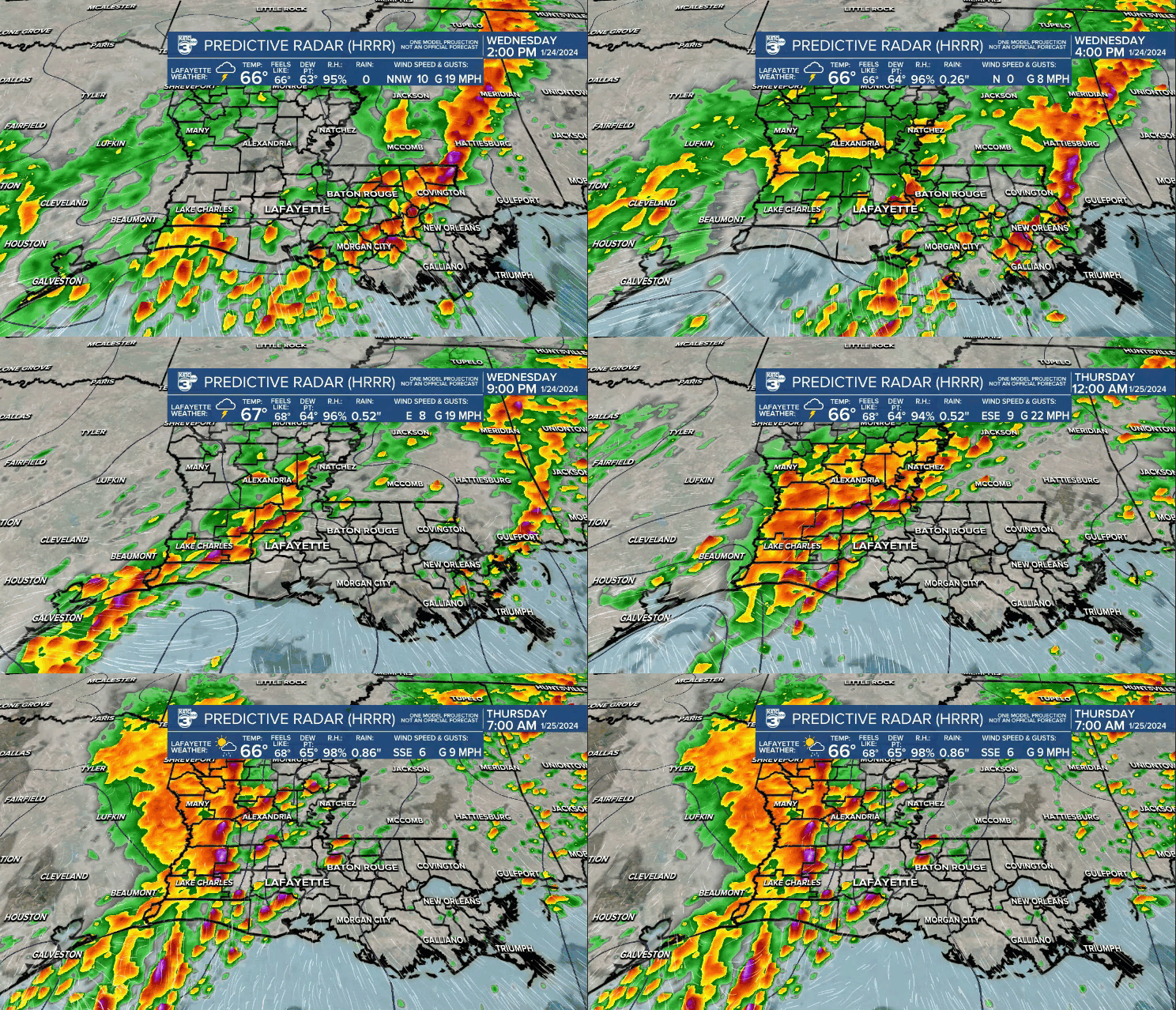
A couple more waves of moisture will work in this evening, tonight and thru early Thursday morning.

A flash flood WATCH remains in effect thru midday Thursday with an additional 1-3" likely for most of us (isolated higher amounts in spots—especially our southeastern parishes).


We'll keep you updated with any additional flood issues that may arise.
There is still a low-end risk of a couple strong to severe storms, but the overall risk remains low.

Showers and storms will gradually come to end west to east Thursday morning.
By the afternoon, most of the rain will be out of here.
It'll stay mild with temperatures in the 60s/lower 70s.
Another round of showers will arrive Friday—especially late Friday into early Saturday.
Thereafter, the pattern will finally turn drier and cooler for the end of the weekend and start of next week.
Stay dry out there and avoid flooded areas!
------------------------------------------------------------
Stay in touch with us anytime, anywhere.
To reach the newsroom or report a typo/correction, click HERE.
Sign up for newsletters emailed to your inbox. Select from these options: Breaking News, Evening News Headlines, Latest COVID-19 Headlines, Morning News Headlines, Special Offers


