


LOWS TONIGHT: UPPER 50s
HIGHS MONDAY: LOW-MID 70s
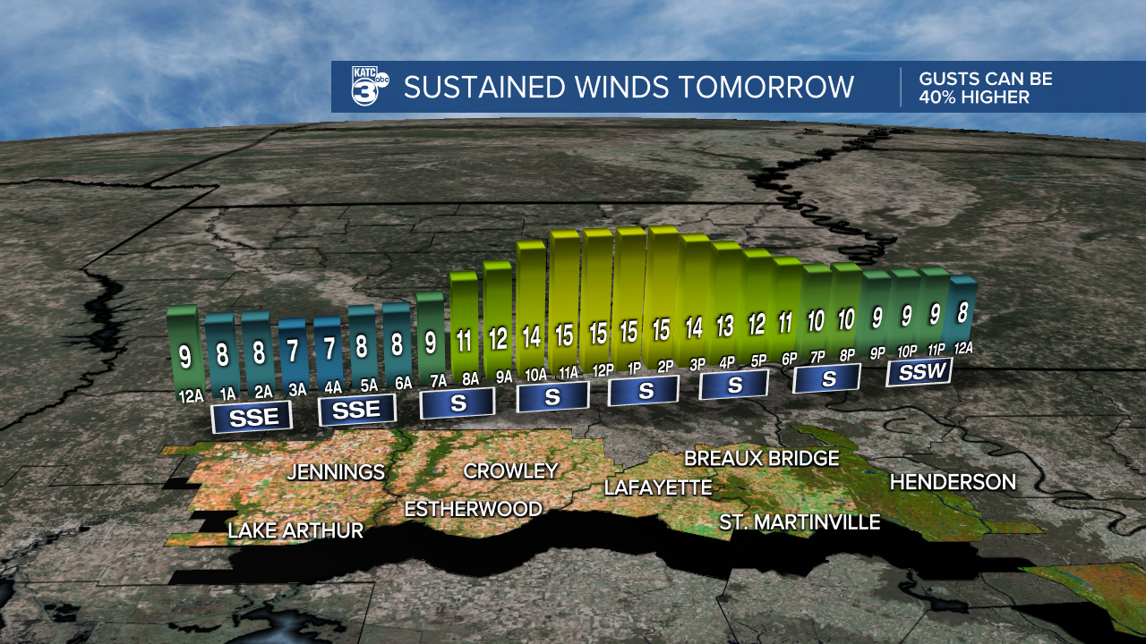
DISCUSSION
Low temperatures will likely occur around midnight tonight before readings start to rise closer to the mid-60s by daybreak Monday.
Expect considerable cloud cover out there for MLK Day as highs push the low-mid 70s.
Winds will remain breezy out of the south at ~10-15mph.
I do believe we'll see a few passing, light showers, but any rainfall we were to see would remain rather light in nature.
Holding rain chances at 30-40%.
Tuesday will feature warm conditions as highs push well into the mid-upper 70s under partly-mostly cloudy skies.
It'll stay quite warm Wednesday ahead of a cold front that will get here late in the day—more so Wednesday evening/night.

The SPC already has Lafayette on northward under a slight risk for severe storms, so we'll have to monitor the progression of this system closely over the next couple of days.
We'll then turn drier and nicer Thursday into Friday before another disturbance enhances our rain chances once again for Saturday.
No severe weather is anticipated with this second system as of now
Have a great week!
------------------------------------------------------------
Stay in touch with us anytime, anywhere.
To reach the newsroom or report a typo/correction, click HERE.
Sign up for newsletters emailed to your inbox. Select from these options: Breaking News, Evening News Headlines, Latest COVID-19 Headlines, Morning News Headlines, Special Offers
