The forecast is calling for another round of high, late summer heat with highs expecting to move into the mid 90s and the heat index much warmer.
Temperatures have been on the rise as a result of a lack of showers, dry air has taken over and is giving us a chance to dry out.
Unfortunately, the dry air won't make things feel crisp outside, there's still enough for it to still feel plenty muggy out.
This drier pattern is going to hold on through the middle of the week, eventually giving way again to daily afternoon showers and storms.
Moisture returns on Thursday and along with it showers and thunderstorms that will flair up in the afternoon through the end of the week and the weekend.
In the Tropics:

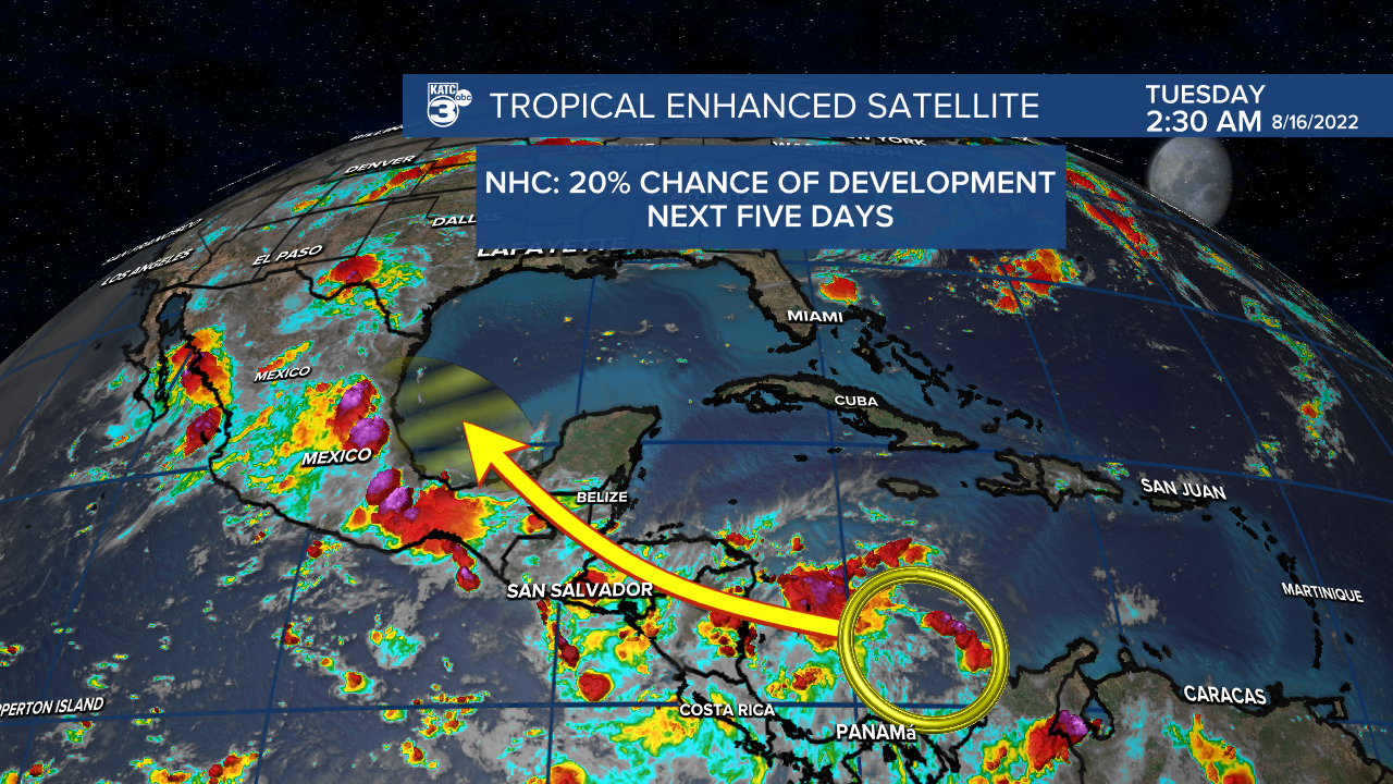
An area of interest has emerged in the south Caribbean Sea, near the coast of Colombia, which may show further signs of development over the next couple of days.
Development, if any, would be slow and a depression may emerge in the next five days the NHC is giving it at this time a 20% chance.
Models aren't overly optimistic at this point although they have picked up on the wave, regardless it doesn't look like anything for Louisiana to worry about.
In fact this could help bring some rain in drought stricken areas of south Texas and north Mexico which could be beneficial.
------------------------------------------------------------
Stay in touch with us anytime, anywhere.
To reach the newsroom or report a typo/correction, click HERE.
Sign up for newsletters emailed to your inbox. Select from these options: Breaking News, Evening News Headlines, Latest COVID-19 Headlines, Morning News Headlines, Special Offers


