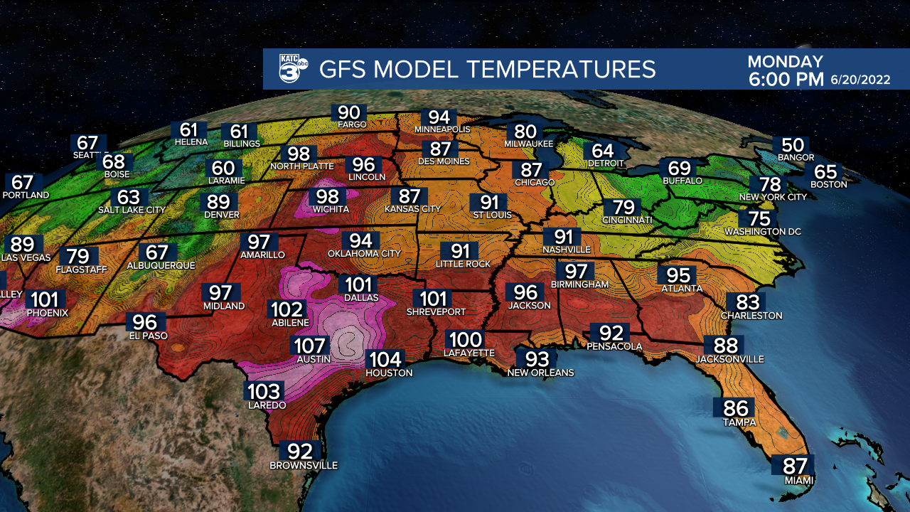
Well, some of you saw relief from the heat today courtesy of a cooling afternoon shower or thundershower.
Any activity still on the radar this evening will come to an end prior to midnight.
Mild and muggy overnight with lows in the mid-upper 70s.
A hot end to the week Friday as highs push into the mid-90s under generally partly cloudy skies.
Heat indices will approach 102°-106°.

A few isolated storms possible into the afternoon, but coverage will be a little less compared to today.

The heat stays on big time this weekend and well into next week.
Expect highs to push well into the mid-upper 90s.
Long-range models continue to insist that some areas in Acadiana may hit triple digit readings...

We'll see, but regardless, it's going to be quite hot out there, so make sure you are staying hydrated and taking plenty of breaks.
With a ridge of high pressure overhead, that will limit our rain chances to 20% or less.
To say the least, we are in the middle of an early summer heatwave across the deep south... Stay cool!
TROPICS
The area of disturbed weather near central America now only has a 10% chance of development.

All of the moisture associated with it will remain well to the south and west of the region.
Rest of the tropics are quiet at this time.
Stay with KATC for the latest.
------------------------------------------------------------
Stay in touch with us anytime, anywhere.
To reach the newsroom or report a typo/correction, click HERE.
Sign up for newsletters emailed to your inbox. Select from these options: Breaking News, Evening News Headlines, Latest COVID-19 Headlines, Morning News Headlines, Special Offers


