


Freezing temperatures are in the forecast for Acadiana Tuesday morning with wind chills as cold as the mid-20s.
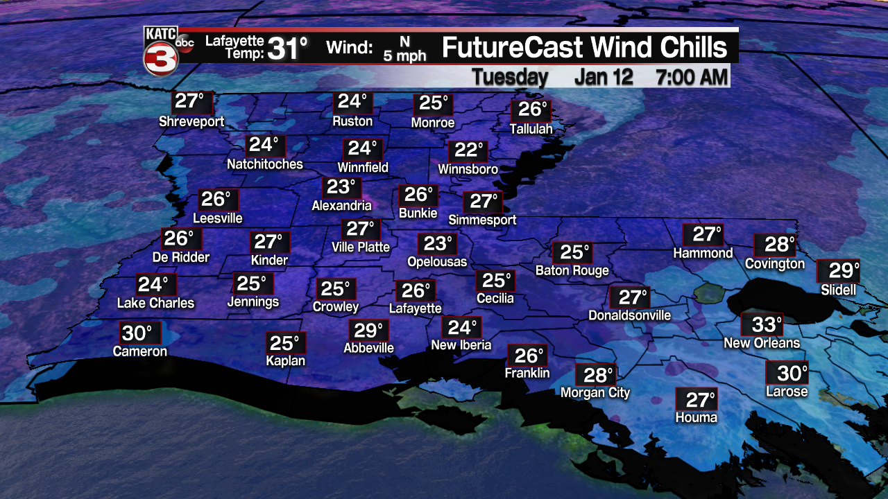
The freeze should not be a pipe-buster, however into Central Louisiana, a Hard Freeze Warning is in effect where temperatures could get as low as the low-mid 20s.

Temperatures will be dictated by cloud cover and wind...the more cloud cover and the breezier the winds, the warmer the temperatures will be.

Readings by daybreak for most of Acadiana will likely range in the upper 20s if we clear out, to lower 30s if clouds persist.
Cloud cover forecasting in the wake of cold low pressure systems is always tricky with models usually more optimistic about clearing trends.

Clouds should thin in spots overnight, with clouds trying to rebuild in areas by daybreak.
And there's a wrinkle in tonight's forecast for Acadiana and it's not a done deal...if we do clear out there is the chance of fog developing across portions of the area.
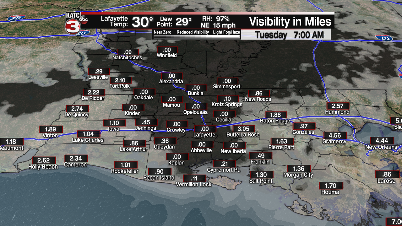
And with temperatures dropping below freezing we could see some freezing fog that could make for potentially a few slippery road spots with some rime icing possible especially across northern Acadiana into Central Louisiana by morning...that's if skies clear and fog kicks in within a few hours after clearing.
Will watch our trends closely for this just in case...
Tuesday will be milder...depending on any lingering cloud cover and when it burns off.
Nonetheless, expect some clouds to start our Tuesday with sunny skies returning for the afternoon.
Temperatures will be some 10° warmer than Monday with highs in the upper 40s to near 50°.

Another upper disturbance should swing through the area Tuesday night ushering some high clouds and making for another tricky temperature forecast.
For now plan on lows in the lower 30s with a potentially good chance of a moderate to heavy frost by Wednesday morning.

Bottom line: protect the plants and make sure the pets have a warm place to stay over the next couple of nights.
Mostly sunny skies with temperatures moderating into the upper 50s are expected Wednesday afternoon and look for even milder readings to reach the mid-upper 60s Thursday ahead of our next front Friday.

Friday's front is expected to arrive prior to daybreak with low rain chances anticipated.
Friday's front will have some bitterly cold arctic air behind it but it appears the Acadiana will receive only a glancing and short-lived glancing blow with the main impetus east of our area.
This weekend should be a chilly one under fair to partly cloudy skies with highs in the low-mid 50s accompanied by overnight lows in the low-mid 30s.
See the KATC 10 Day Forecast for the latest.
------------------------------------------------------------
Stay in touch with us anytime, anywhere.
To reach the newsroom or report a typo/correction, click HERE.
Sign up for newsletters emailed to your inbox. Select from these options: Breaking News, Evening News Headlines, Latest COVID-19 Headlines, Morning News Headlines, Special Offers
