


It seems the heat wave that has gripped Acadiana for the last several days has finally started to break.
Temperatures are still expected to be slightly above normal on Wednesday, but a round of overnight showers has dropped temperatures into the mid 70s for the first time in days.
The ridge that was responsible for the recent round of hot temperatures has inched west which has allowed showers to move back into the area.
While we are still looking at mid 90s for the high, we should get some relief from showers and storms that are expected to pop up in the afternoon.
A few strong storms will be possible but it doesn't look like they'll reach the same kind of intensity as the ones we saw develop on Tuesday.
The rest of the week will look more typical for summer time with highs in the low 90s and spotty showers possible every afternoon.
A massive ridge, however, will set up over Acadiana again over the weekend and in turn will squash rain chances and raise temperatures for next week.
Another string of 99 degree days looks possible for a majority of next work week.
In the Tropics:
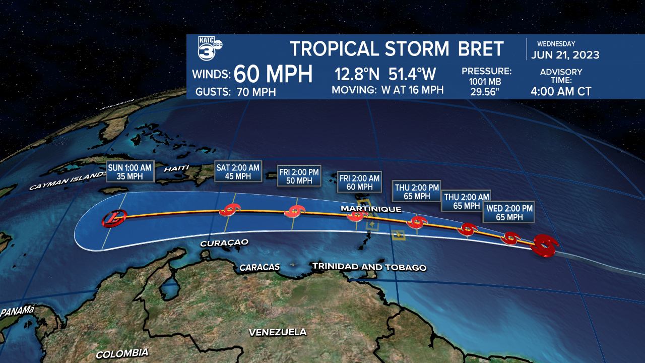
The tropics remain active with Tropical Storm Bret working toward the Lesser Antilles as a strong tropical storm, and is followed by another wave that continues to show decent signs of further development.
Neither look to be an issue for Acadiana as Bret is expected to fizzle out in the Caribbean and the other wave will likely linger in the Atlantic.
------------------------------------------------------------
Stay in touch with us anytime, anywhere.
To reach the newsroom or report a typo/correction, click HERE.
Sign up for newsletters emailed to your inbox. Select from these options: Breaking News, Evening News Headlines, Latest COVID-19 Headlines, Morning News Headlines, Special Offers
