Even with a fair amount of high clouds today preventing heat indices from getting as high as Thursday morning lows did not dip below 80 thus we had our 2nd straight heat advisory for Acadiana which continues until 7PM.
The clouds look to stay with us through the overnight hours which should keep lows near 80 again thus I think we will have another heat advisory on Saturday.
Also, with a bit more breaks in the clouds and extra sunshine Saturday afternoon heat indices will reach the dangerously hot levels of 106-109, so make sure you are taking it easy, drinking plenty of water and finding a way to stay cool.

Sunday might be more like Friday with a little bit more in the way of clouds but it will still be really hot and humid with feel like temperatures between 104-108.
Now Sunday afternoon/evening an upper level wave might move over the region sparking off a few isolated showers and storms but these will be the typical pop-up showers that only last 15-30 minutes, so don’t cancel any outdoor plans and if you are lucky enough to get a brief shower it should help to cool things off.

Monday still looks to be our best chance for scattered showers and storms but that is now not looking like a sure thing anymore.
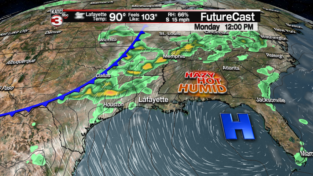
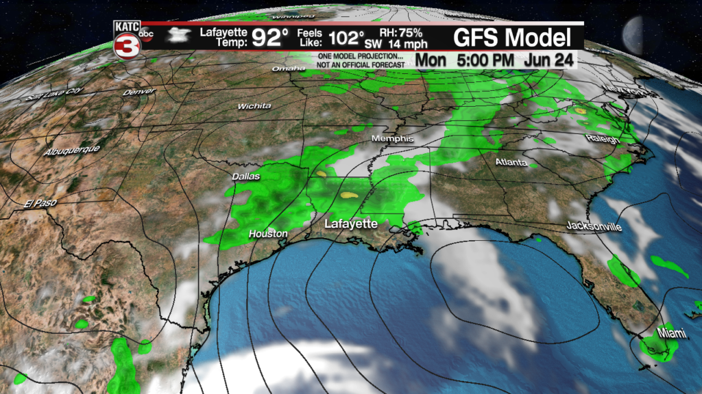
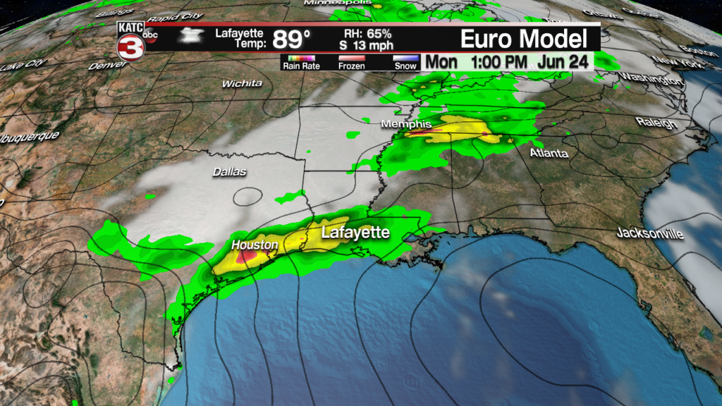
We are still going to have the surface high in the eastern Gulf and latest mid range models think that high might hold on tight and prevent the approaching tough to our northwest from reaching Acadiana.
Here is a look at the RPM and you can see this still has the line of showers and storms to our north at noon.

Looking the GFS it has the showers diving south but only making it til about Alexandria before dying out as the high pressure will block the rain from pushing into south Louisiana.

But the Euro has the high pressure falling a part allowing the tough the swing down into Acadiana to bring rain to the area.

In the coming days we will have to see which will win out the high pressure which will mean lower rain chances or if the tough can overcome the high and push showers into Acadiana to bring us the much needed rain.
Right now I am leaning towards the drier forecast for Monday with those near highway 190 having the best chance to maybe get a scattered shower or storm Monday afternoon/evening.
Tuesday and Wednesday look hot and dry with heat indices climbing back to above 105.
The good news is overnight lows next week might not be as disgusting as we could get morning lows to dip into the lower 70s.
Then towards the end of next week into the following weekend an unsettled pattern looks to return to Acadiana giving us the possibility of several days with decent chances for scattered showers and storms during the afternoon which might finally give us some relief from the extreme heat.

