Late tonight into Sunday morning the tail end of the line of storms will try to work across Acadiana producing scattered showers and thunderstorms.
Timing for these storms will start about 4 am for our northwestern parishes, reaching Lafayette between 7-8 am before clearing St. Mary parish about noon.
Here is a look at the latest predictive radar.
As these storms move into Acadiana there is a low end threat a couple could be on the strong to severe side with damaging wind gusts up to 60 mph as the main concern but some large hail or a spin-up tornado can not be ruled out but those chances only look to be about 1-2 percent.

Also, these showers and storms should move through pretty quick so flooding will not be a concern as most spots will only get about a tenth to a quarter of an inch of rain.
Once the main line of showers/storms moves through it will be a warm and humid day with partly sunny skies and maybe one or two stray pop-up showers.
Monday will be hot and humid with highs pushing 90 and the slight chance for a stray afternoon shower.
Winds turn breezy Tuesday out of the SSE at 15-25 mph with gusts up to 30 mph which should create enough mixing in the atmosphere to hold temperatures in the mid to upper 80s.
Beyond Tuesday an upper level ridge will build over the Southeast setting up a summer-like pattern for the end of the work week into Memorial Day weekend.
Highs Wednesday through Memorial Day will top out in the lower 90s each day with heat indices reaching the mid to upper 90s.
Also, thanks to the ridge rain chances will be just about zero meaning there will be no issues for your Memorial Day plans just make sure to remember the sunscreen and to drink plenty of water.
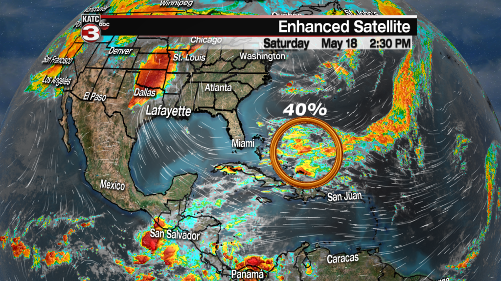
And with the summer-like feel to the forecast this week it’s time to start keeping an eye on the tropics where the National Hurricane Center is monitoring a board area of showers and storms to the east of the Bahamas.

With the latest advisory the hurricane center gives this area of disturbance a 40% chance of development over the next 5 days.
Good news is the system is moving to the NE out into the open Atlantic and away from any landmasses.


