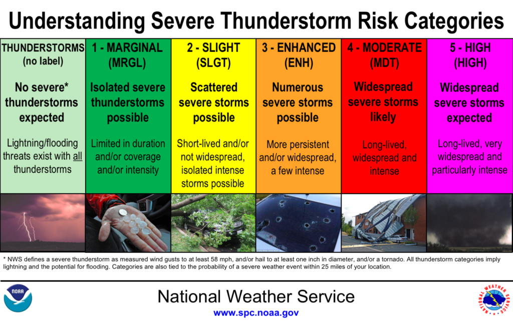
The Storm Prediction Center (SPC) upped the threat of severe weather for much of Acadiana Thursday from “Slight” to an “Enhanced Risk”, a level 3 out of 5.

Another strong storm system is heading this way, and just because we didn’t see much severe weather the last time we had and enhanced risk over the area Saturday, does NOT mean that we won’t see severe weather this time around!
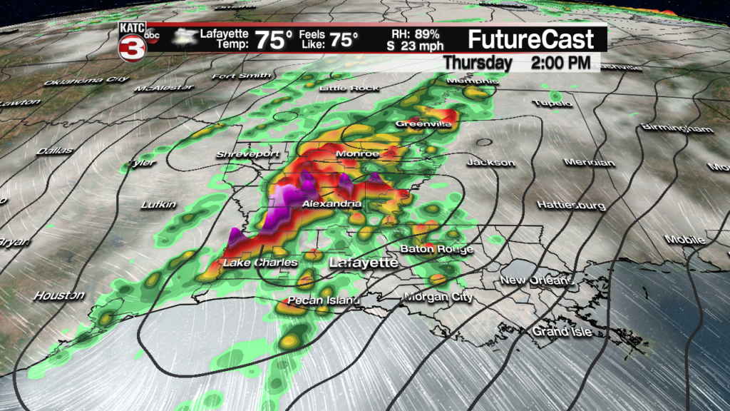
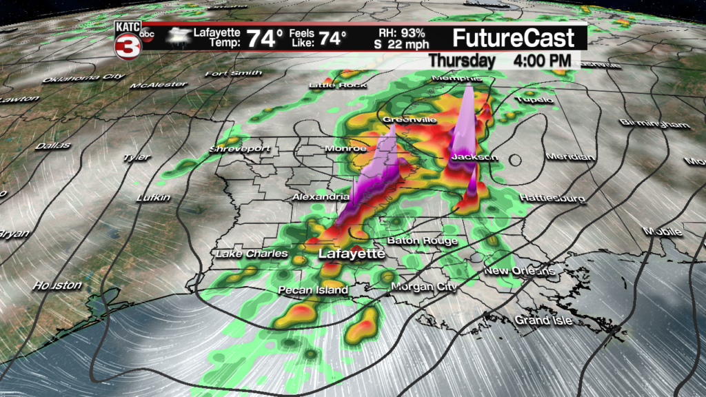
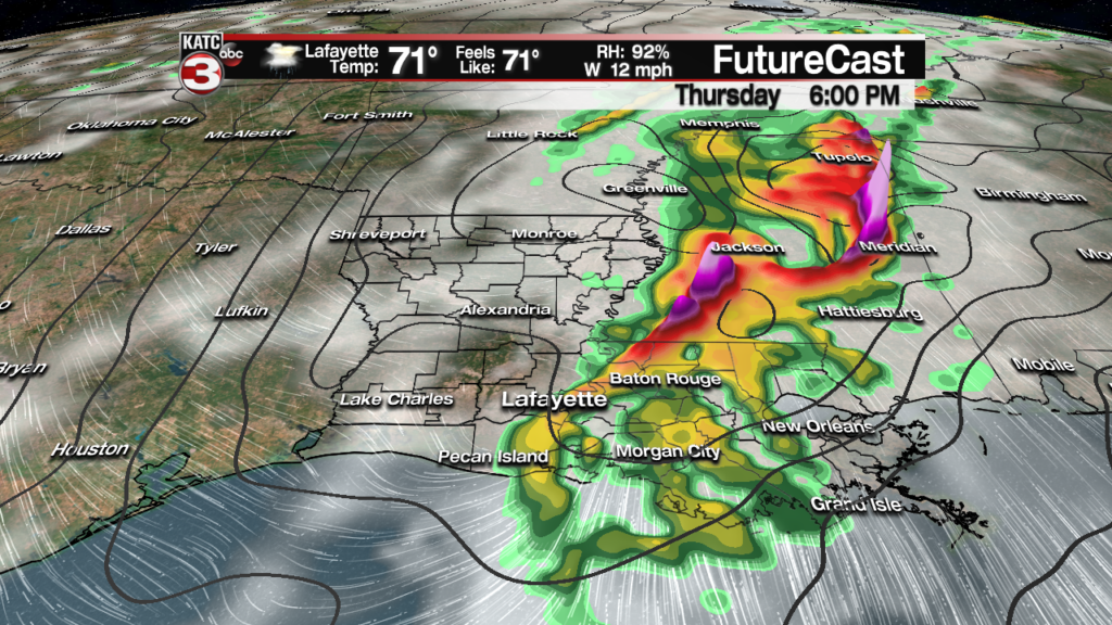
The main threats Thursday may be two pronged: first will be the threat of individual discrete (loner), rotating storm cells ahead of a main squall line that will developing farther to the west Thursday mid-late morning into the early afternoon, and second, embedded severe storms with the potential squall line into the latter part of the afternoon, and perhaps very early evening.
Per the SPC, damaging winds and a “strong” tornado or two will be possible. Strong tornadoes are considered of EF2 strength (111 mph winds) or greater.
Storm prime-time Thursday for most of Acadiana, give or take a few hours, should be from noon through 6 pm.
So stay weather aware and be up on the latest forecast going into Thursday.
In the near term, expect a gradual increase in cloudiness through Wednesday.
It should be dry Wednesday but we can’t rule out an isolated shower possible, especially western sections of Acadiana by late in the day.
Expect a few intervals of sunshine in between the clouds Wednesday which should push our temperatures back into the lower 80s for the afternoon.
Breezy southeast winds will kick in Wednesday afternoon with gusty conditions likely developing overnight through Thursday.
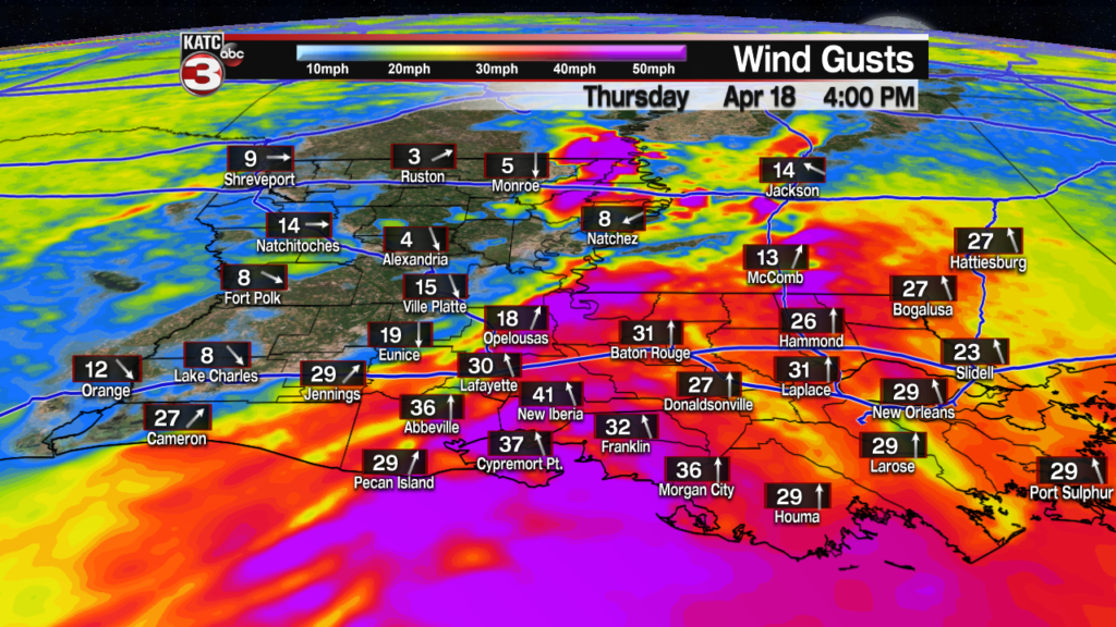
Latest Wind Forecast:
 Acadiana 1 Hour Wind Forecast


Gusts Thursday afternoon could reach the 40-45 mph range, away from storms, just like they did Saturday…which could lead to a few isolated tree limbs and/or trees falling and sporadic, localized power outages.
Those strong winds into Thursday will also likely push tides up to 2 feet above normal along the coast with similar inundations, especially seen at Cypremort Point this past weekend.
There will be a significant severe weather threat in Texas and portions of Oklahoma Wednesday, with that severe threat translating eastward into Louisiana as mentioned above Thursday.


Cooler, drier air will follow this weather system Friday with fair to partly cloudy skies accompanied by high temperatures in the upper 60s to lower 70s.
Temperatures will cool nicely Friday night into Saturday morning with readings dropping into the upper 40s to lower 50s.
The Easter Weekend looks great with sunny skies accompanied by highs in the mid-upper 70s Saturday and the upper 70s to lower 80s Sunday.
Here’s a quick guide to severe storm outlooks: