Today we ran the stretch of beautiful weather in Acadiana to 6 days but changes are coming to the forecast.
The first changes arrived this afternoon as winds picked up out of the south pumping Gulf moisture over the region as dew points have climbed into the lower 60s producing a fair amount of clouds.
With this additional moisture in the atmosphere patchy to dense fog will be an issue Monday morning with visibility dropping below half a mile in many locations.

Once the fog mixes out we will have a few peeks of sunshine otherwise it will be mostly cloudy and warm with highs in the upper 70s to near 80.

The bigger story on Monday will be a slow moving cold front dropping from the north to south through Acadiana producing a broken line of showers and a few thunderstorms.
The rain will push into the northern half of Acadiana during the late morning/early afternoon while the line will arrive at the I-10 corridor during the afternoon commute.

By the evening the front will reach the coastal parishes producing a few more showers before moving out into the Gulf through the overnight hours.
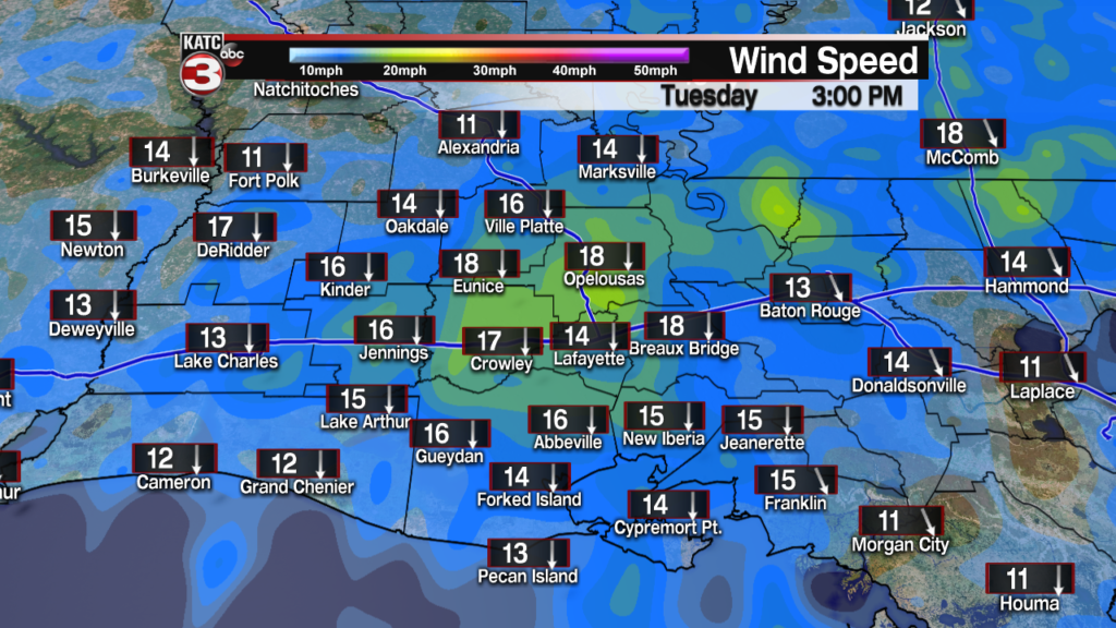
Behind the front Tuesday cooler and breezy conditions will slide down into Acadiana as highs will struggle to reach the upper 60s to lower 70s but with the steady breeze out of the north there will be a definite chill in the air.


With clear skies Tuesday night it will be a chilly start Wednesday morning with lows in the mid 40s but with a full day of sunshine temperatures will rebounded quickly with highs in the low to mid 70s.
As high pressures scoots off to the east clouds will start to return Thursday and Friday but with a southerly flow highs will stay spring-like in the mid to upper 70s.
Beyond Friday the long range models continue to be in very little agreement but right now it does look like the pattern will become unsettled with slight rain chances possible both Saturday and Sunday as our next system tries to swing into the region.
Here is a look at the latest long range European Model:


