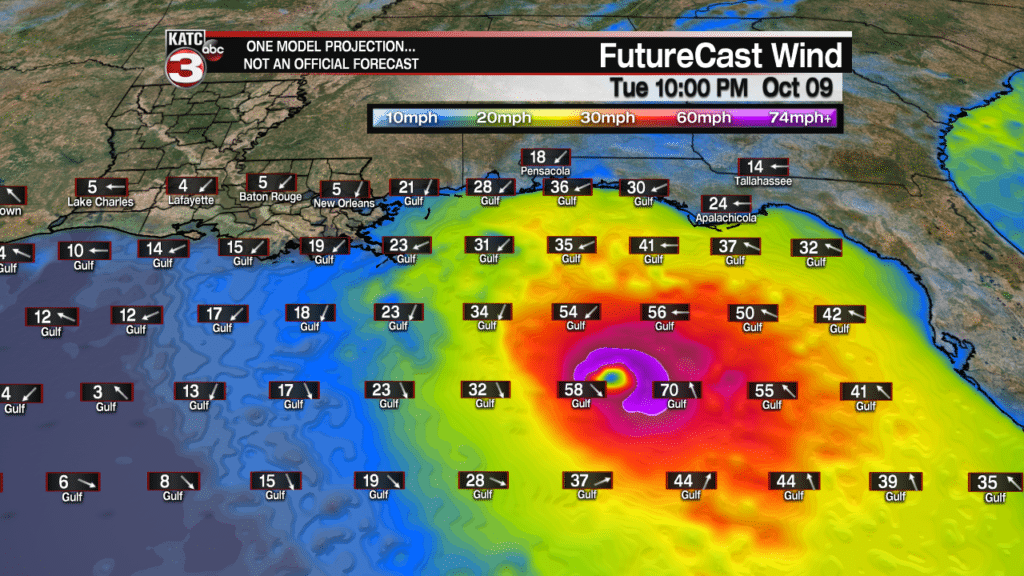
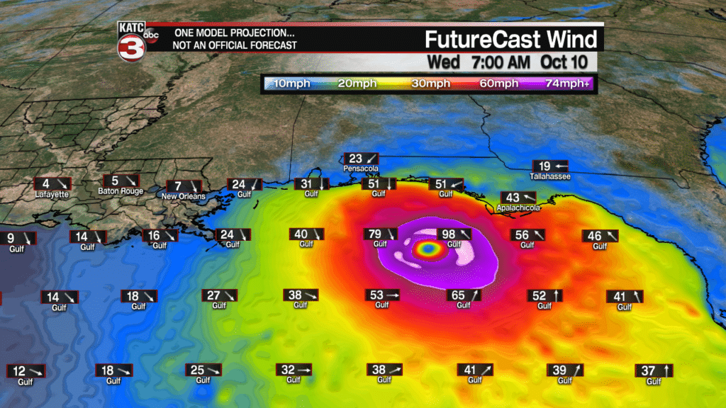
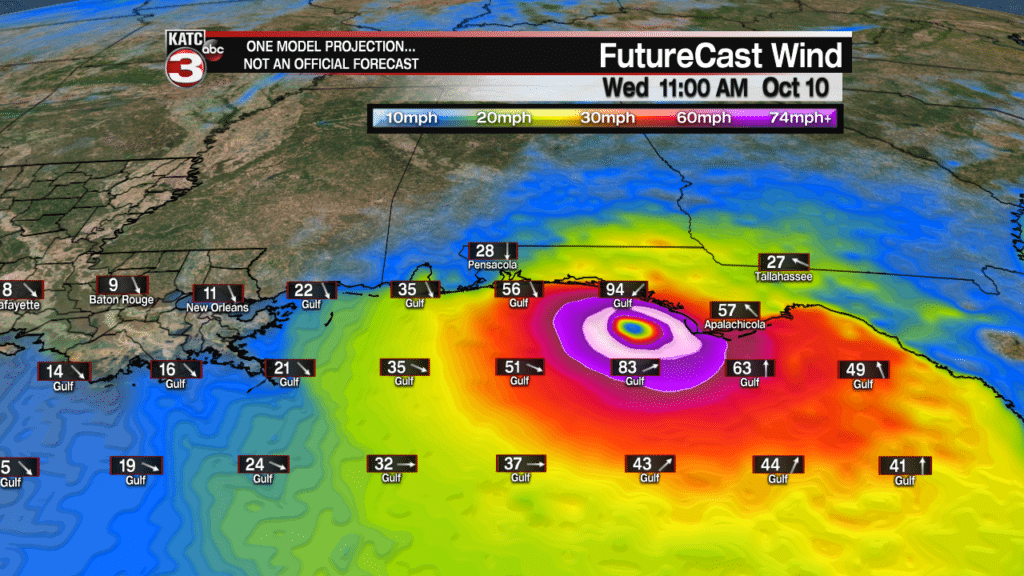
Hurricane Michael is expected to strengthen significantly Tuesday into early Wednesday.
Upper level wind shear should relax tomorrow, and there could be a significant rapid intensification cycle prior to landfall.
You can see where this may happen by only looking out the offshore surface winds when the center of Michael becomes much symmetric in the Northeastern Gulf overnight Tuesday into early Wednesday.
Latest Gulf Offshore Conditions and FutureCast Winds:
Nonetheless, Michael is currently forecast to make landfall Wednesday with near 120mph winds Near Panama City.
Weather conditions should be markedly better toward Destin, Pensicola, and westward, but tropical storm force winds will be possible all the way to the Alabama/Mississippi state line where tropical Storm Warnings and Hurricane Watches are in effect.
Storm surge values I have here are still preliminary and will change as the storm gets closer to the coast…see latest NHC forecasts and Hurricane Local Statements from NWS offices in Florida.


