Acadiana will be under the influence of deep tropical moisture and plenty of atmospheric instability leading to a good chance of scattered showers and thunderstorms this weekend, and through much of the week that follows.
Rain chances will increase into the 60% range or better with activity possible at any time during the day and into the early evening for both Saturday and Sunday.
And in this pattern, there is even a slight chance of a few passing tropical showers at night…but rain chances will be closer to 20%.
Check out the latest FutureCast and FutureCast rain totals below:
No severe weather nor flooding is anticipated with any storms this weekend through the week that follows.
But with any active thunderstorm pattern, a few storms could produce localized gusty winds, brief torrential downpours and frequent cloud to ground lightning on any given day…in other words, typical summer storms for the area.
Hopefully for the Ragin Cajun football game Saturday evening, showers and storms should be decreasing during the first quarter or two for the game, but certainly bring the rain gear, especially pregame tailgating.
As a side note, the Cajuns are playing Coastal Carolina who are coming from the Hurricane Florence flood ravaged area of Conway, SC. Good thoughts for our friends who are dealing with much of what Acadiana and South Louisiana dealt with just two years ago.
Looking down the meteorological road, the first real fall cool front remains quite illusive for Acadiana, with the GFS model teasing the area with fizzling fronts, while the European Model keeps the cool air that will be invading the Plains States in the next week to 10 days several states away from the area.
Eventually some cooler has to arrive locally, but it looks like it will be sometime in October before we see any significant cool-downs.
With that being said, some slightly cooler overnight lows may advect into the region from the northeast toward the end of next week into the following weekend, but our daytime highs will still be pushing the upper 80s and the humidity will stay high.
Here’s the latest European Model Forecast:
As for the tropics, it’s a little more active as of late Friday afternoon with the National Hurricane Center (NHC) tracking four potential development areas in the Atlantic Basin.
The systems in the Central and Northern Atlantic are no concern for the Gulf of Mexico, but the one with a 70% chance of development may transition from a sub-tropical cyclone to a tropical cyclone with time…but if it develops, it will be spinning in the open Atlantic for days with no immediate threat to land.
The disturbance approaching the Northeastern Caribbean looked better on satellite imagery Friday afternoon forcing the NHC to “up” the chance of development to 40%. This system will continue to fight upper shear and dry air ahead of it, so it should ultimately not be a major concern.
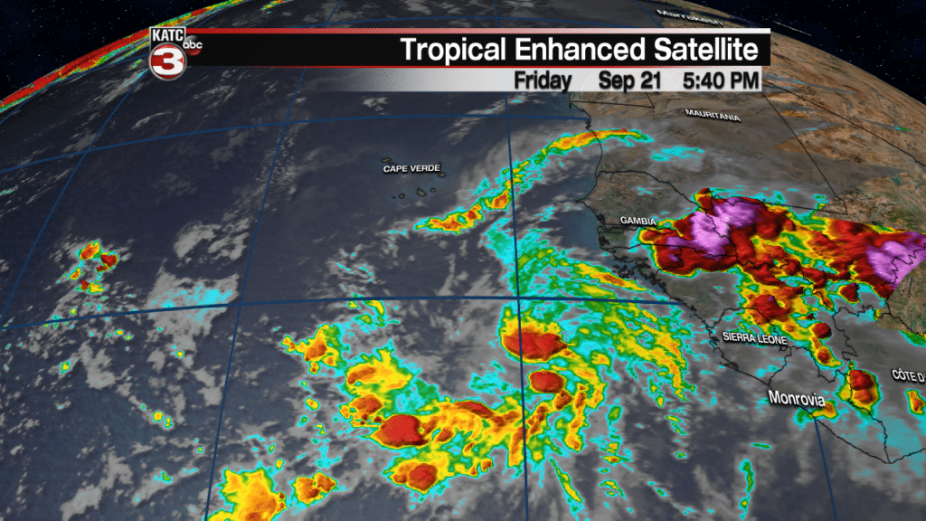
The wave coming off the African Coast however, has a classic Cape Verde signature to it, and may become a long-track/long-lived system to follow over the next 10 days to two weeks…it’s too early to tell whether this system could become a formidable threat to anyone down the line, but one to watch.


